
Go to Welcome
to Rickubis.com for links to my other pages.
Go
back to my RICKUBISCAM page
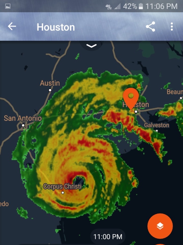
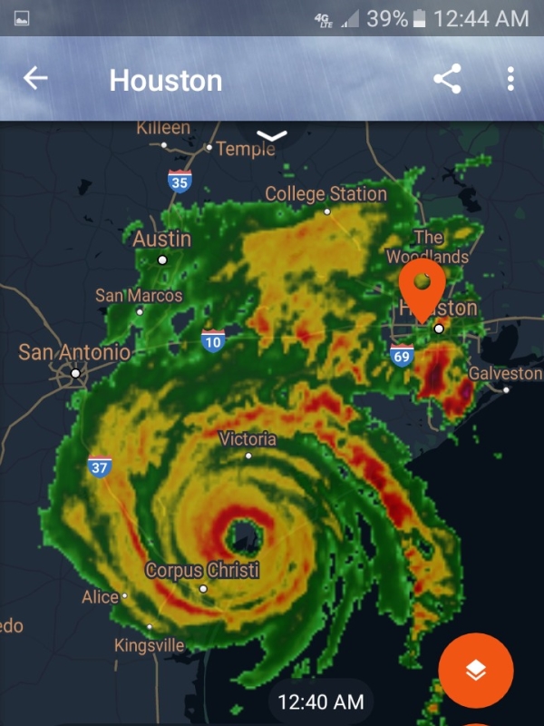
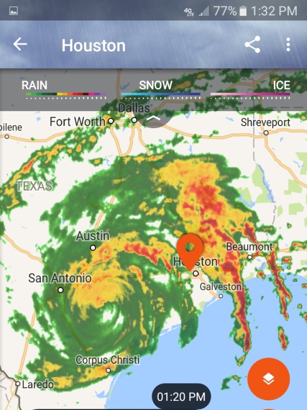
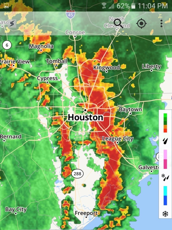
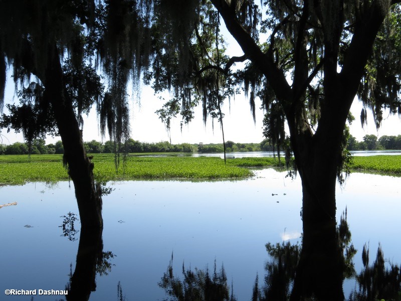
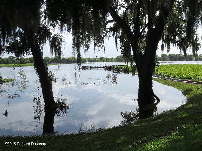
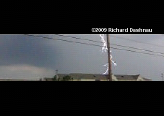
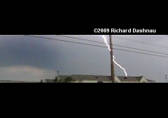
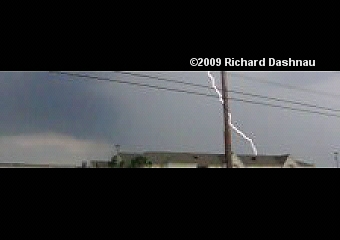
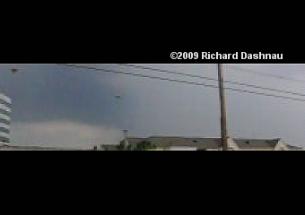
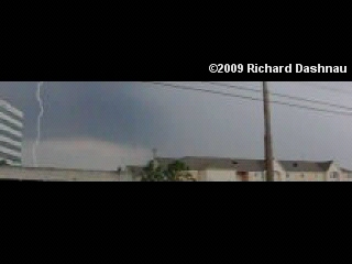
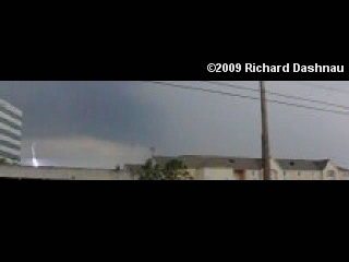
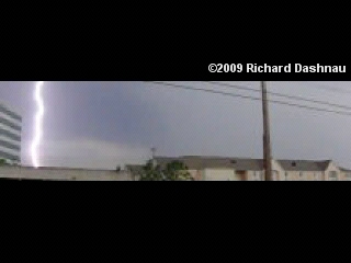
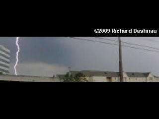
05/16/2024 It's
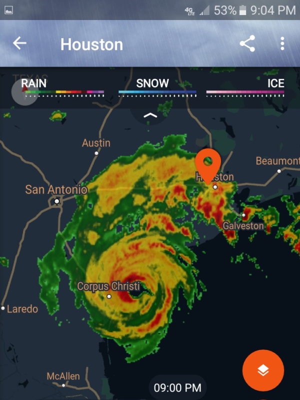
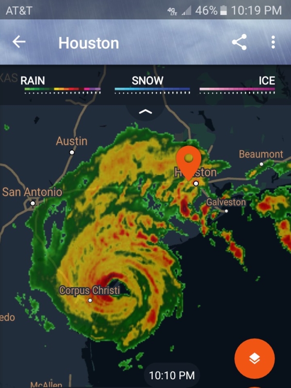
been an interesting week. A derecho blasted through the Houston
area at about 6:30pm on 5/16/2024. I got a "shelter NOW" alert on
my phone.
Since the TV was on, I just changed the channel (because no
tornadoes had been expected) to see meteorologists saying that
100mph winds were due in my
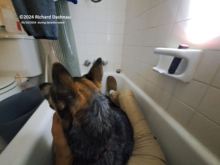
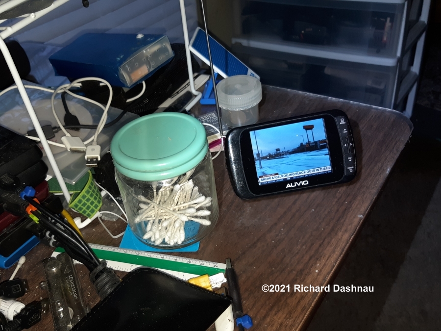
area within minutes. I grabbed the dog, jumped in my bathtub
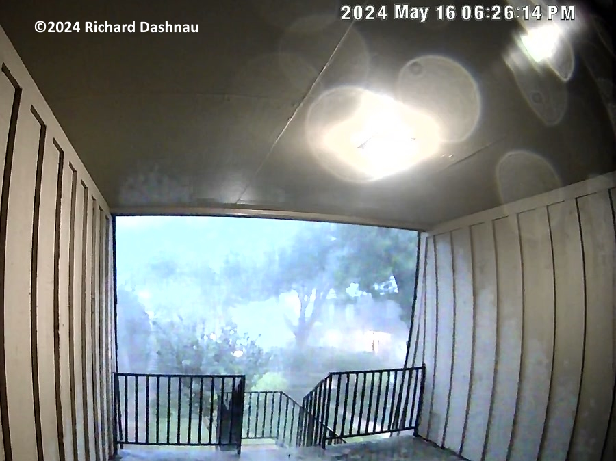
and turned on my flashlight. I was also able to manually capture a
bit of video with my doorbell cam by using my
cellphone.
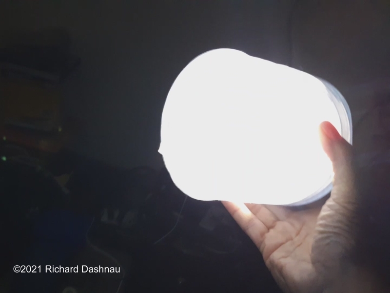
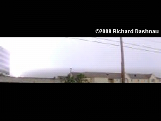
Here
we are in the bathtub. Note the
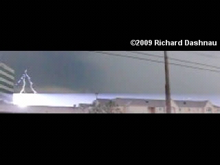
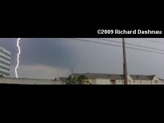
flashlight.
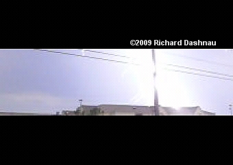
That's a flash of lightning.
Then I
turned off the phone and waited with a trembling dog on my lap. The
lights went out, and the storm passed in about 15 minutes. The
electricity was off,
and Piper and I were ok.
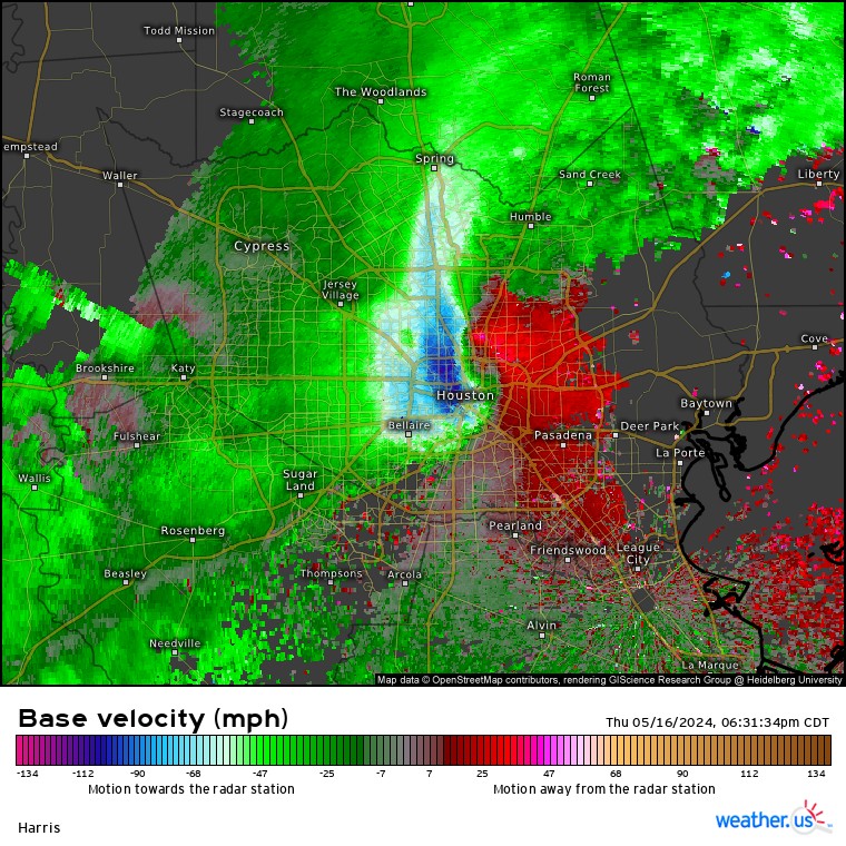
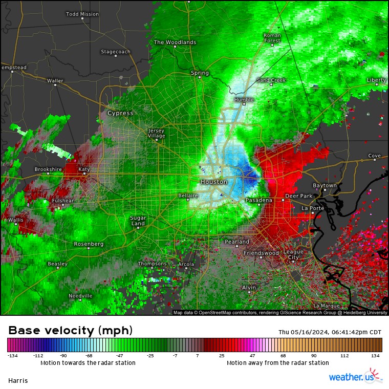
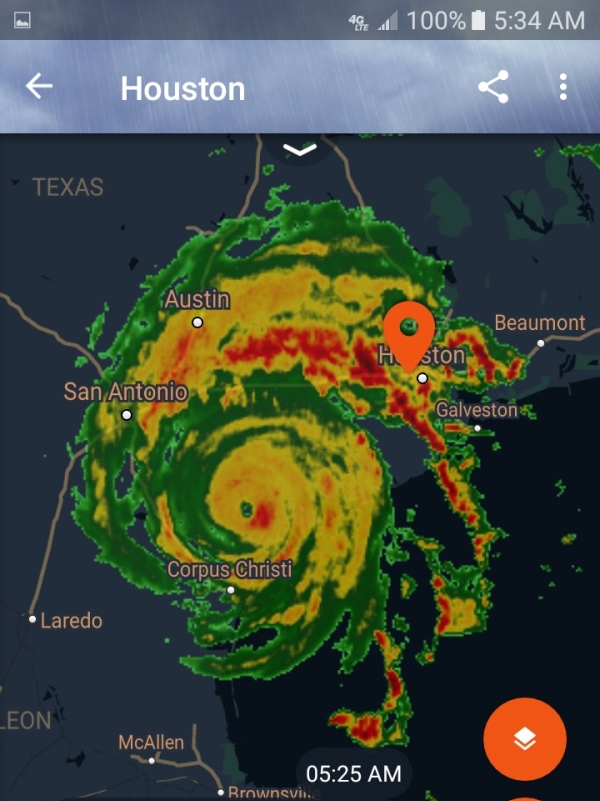
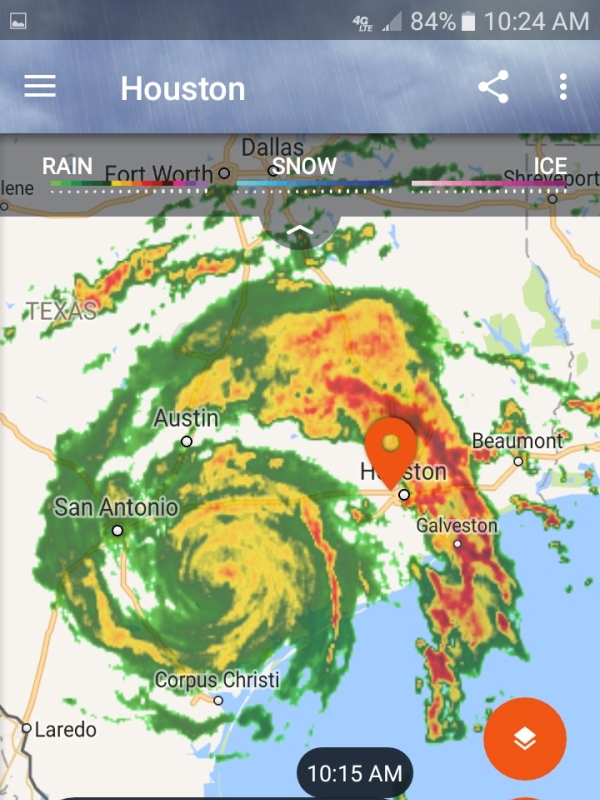
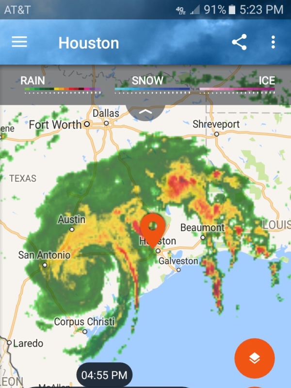
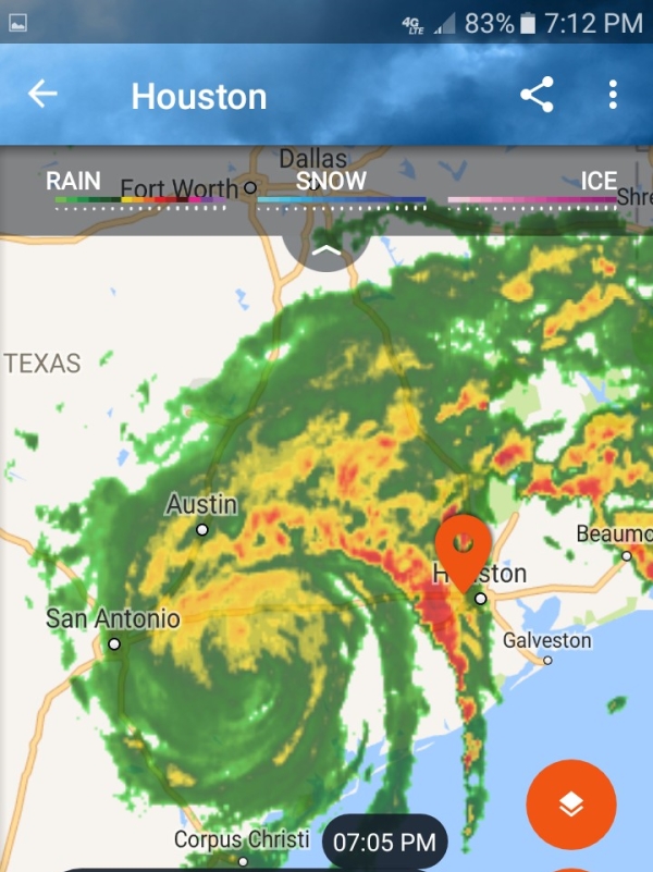
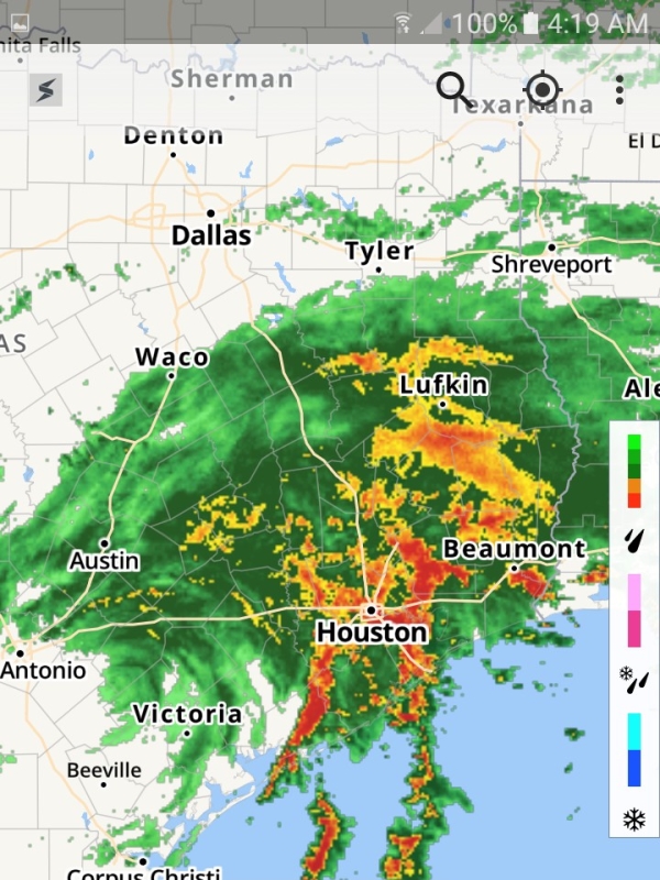
6:11pm PM (I saw this on TV)
6:25pm (In bathtub. Dark spot is over
me) 6:31pm Dark spot is over Downtown
6:41pm It kept going
East.
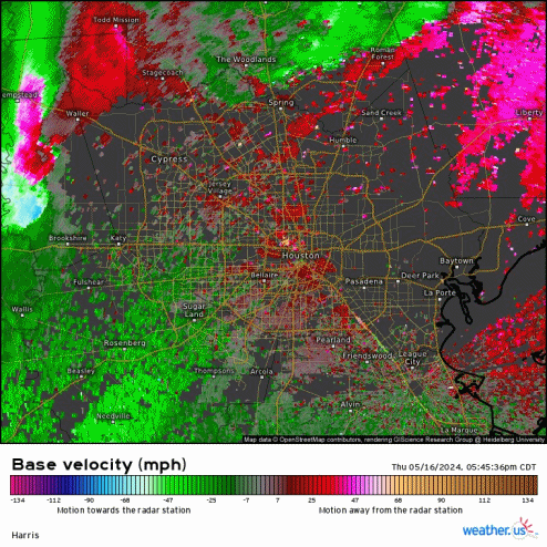
Animated!
I got
the images from here: https://www.noaa.gov/jetstream/velocity
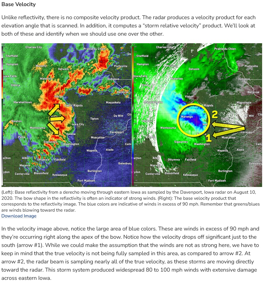
And here's an explanation of the images from the same source.
And,
as they say, the rest is history--as shown on various news reports.
This is my brief account for my own history, and for anyone who
visits this page from out of the area.
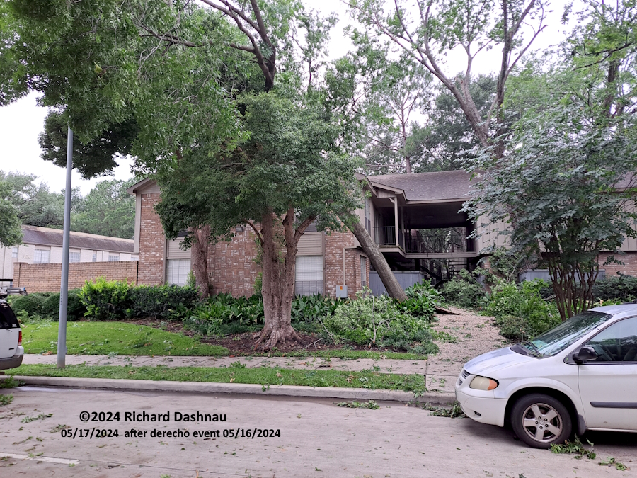
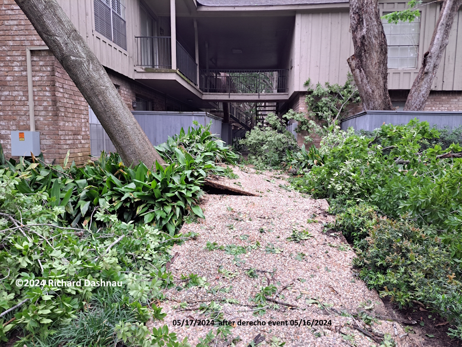
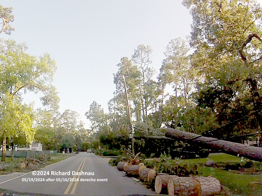
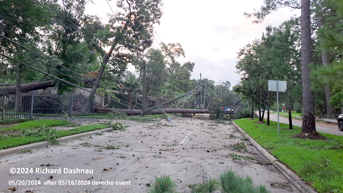
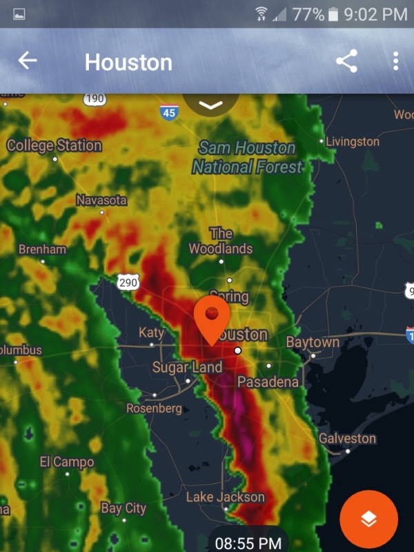
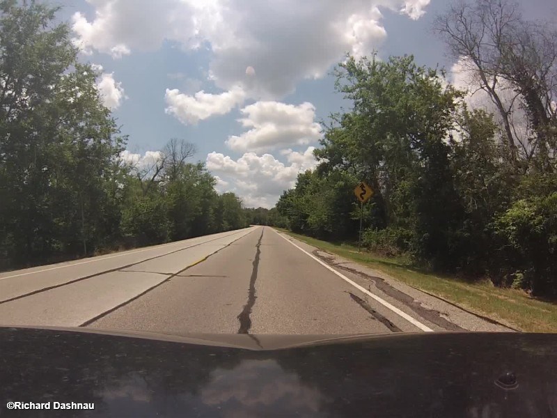
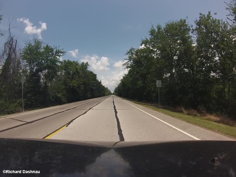
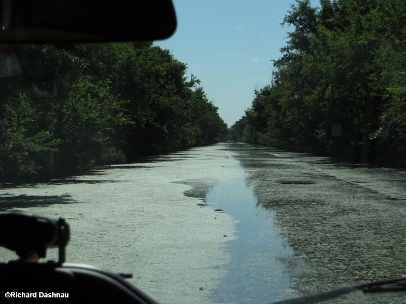
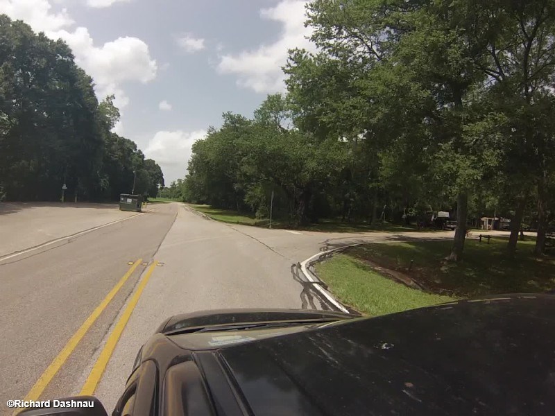
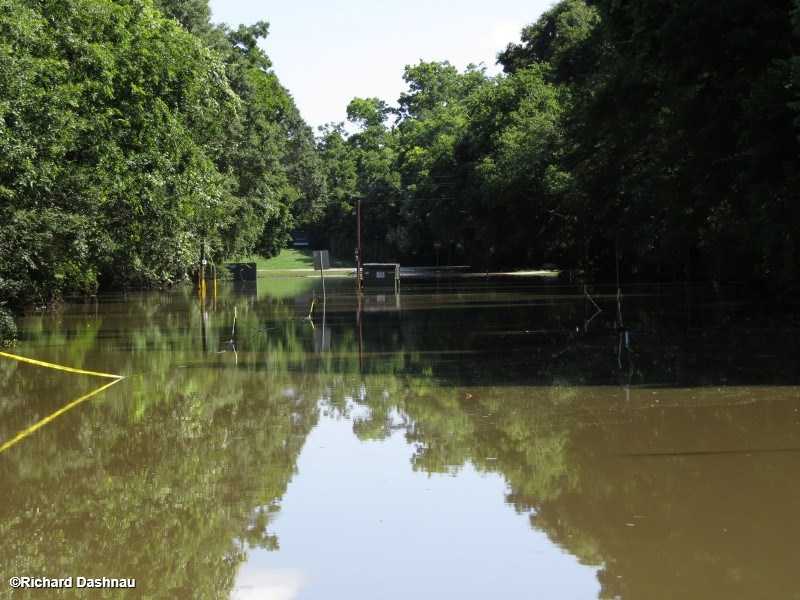
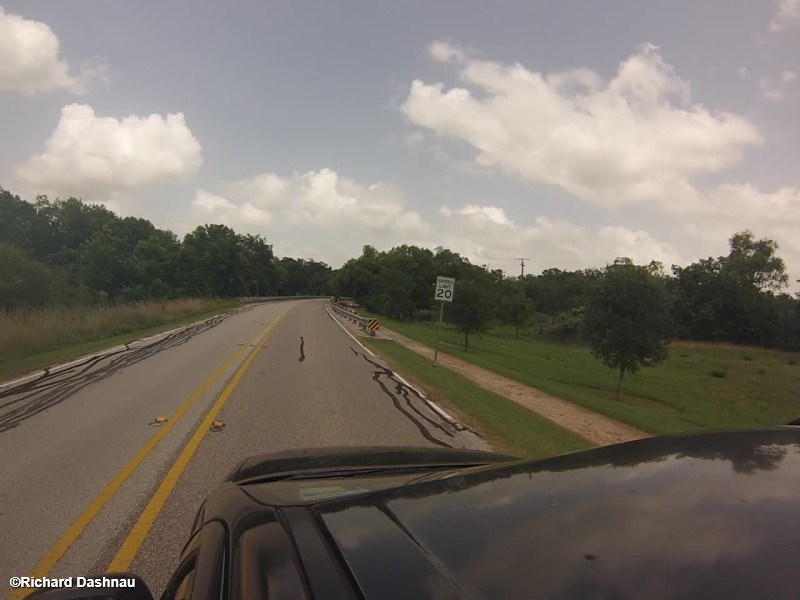
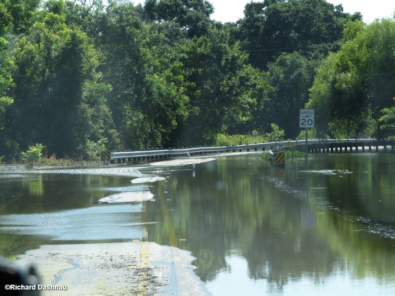
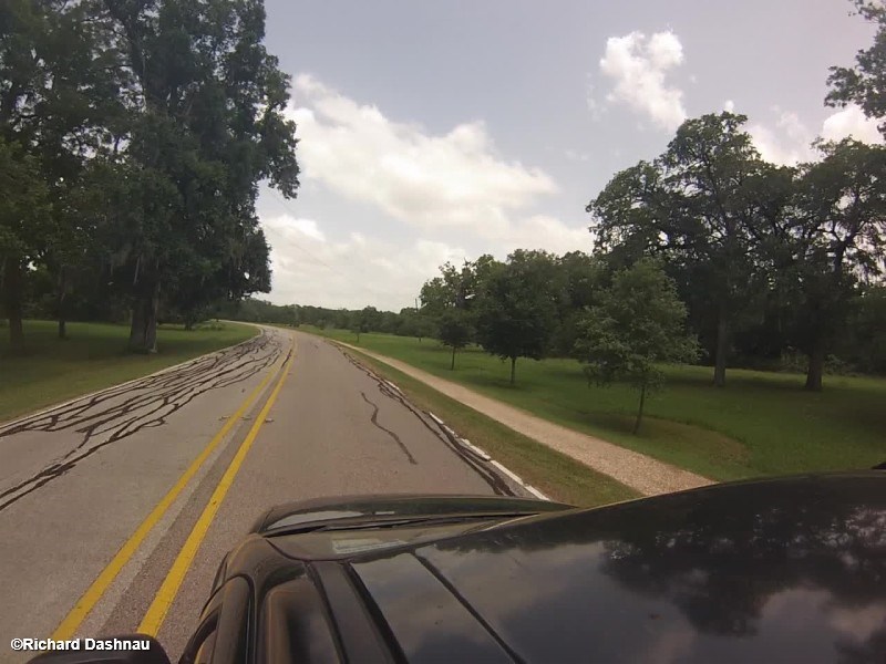
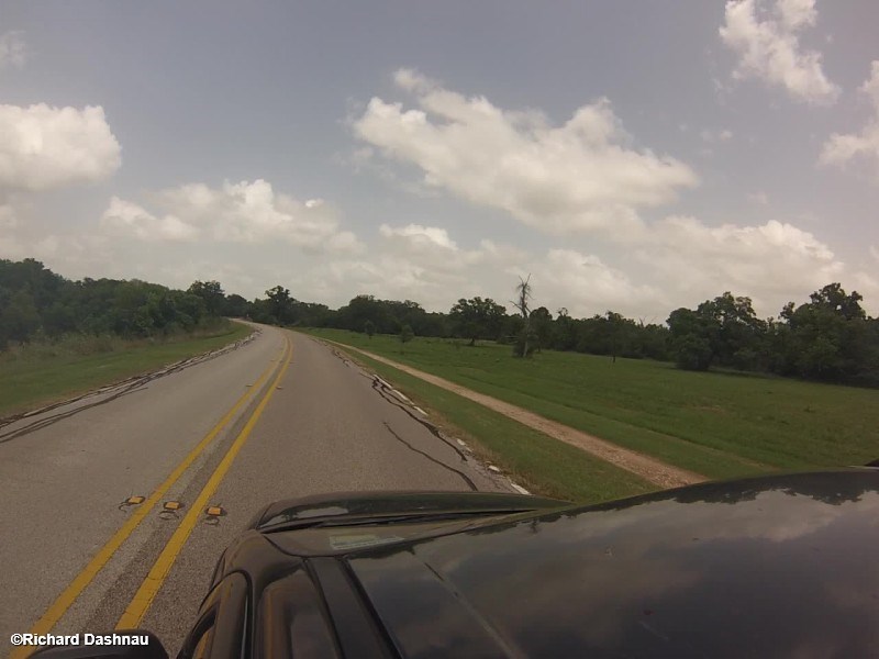
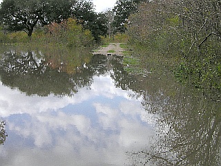
I did not go far for a day or so. And then did an exploratory loop on a couple days to see where there was electricity, or any gas stations open. There were a lot of leaves, light
debris, and small branches scattered around, which I expected. BUT, there were also many, many trees--very BIG trees, also down. Some were snapped about 10 or 20 feet up,
like
twigs, while others just as large or larger (at least 12 inch
diameter trunks) were pushed over, with roots torn out of the
ground. And, some of those trees were lying on top
of
power lines. I found 5 of those just by driving a 7 mile perimeter
around my neighborhood. There must have been hundreds, or thousands,
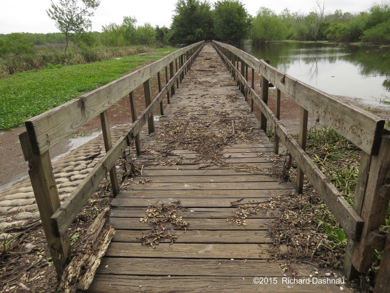
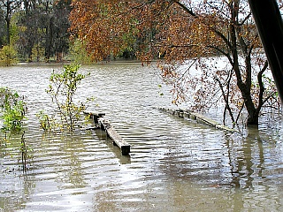
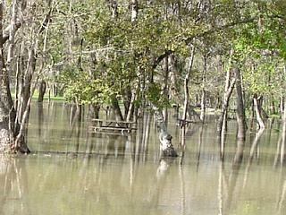
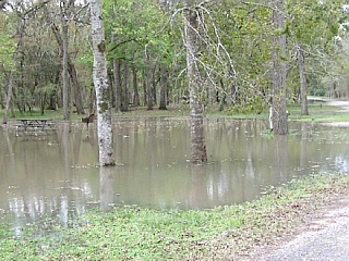
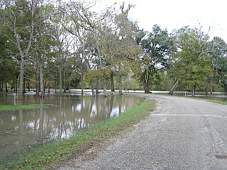
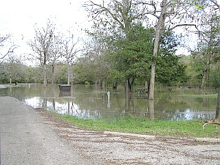
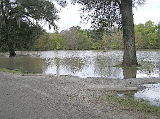
of others. Here are 4 images
from around my home. Look at the size of those trees! Note that the last one below was taken on 5/20--4 days after the derecho event. The logistics involved removing such
large trees from so many different places, from high-voltage lines--without causing more damage and without getting anyone killed or injured while doing it--must have been
amazingly complex. AND they had to have things moved and rebuilt as soon as possible. I saw a lot of damage, but did not photograph much of it. I just saved a few examples
like
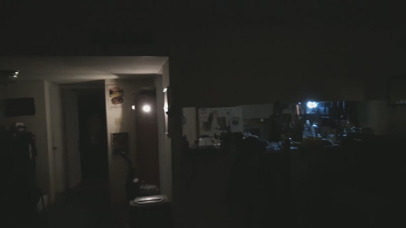
these. Oh...and I do have a few seconds of the storm seen
through a doorbell cam looking down an enclosed landing. Plenty of
other images are on the news.
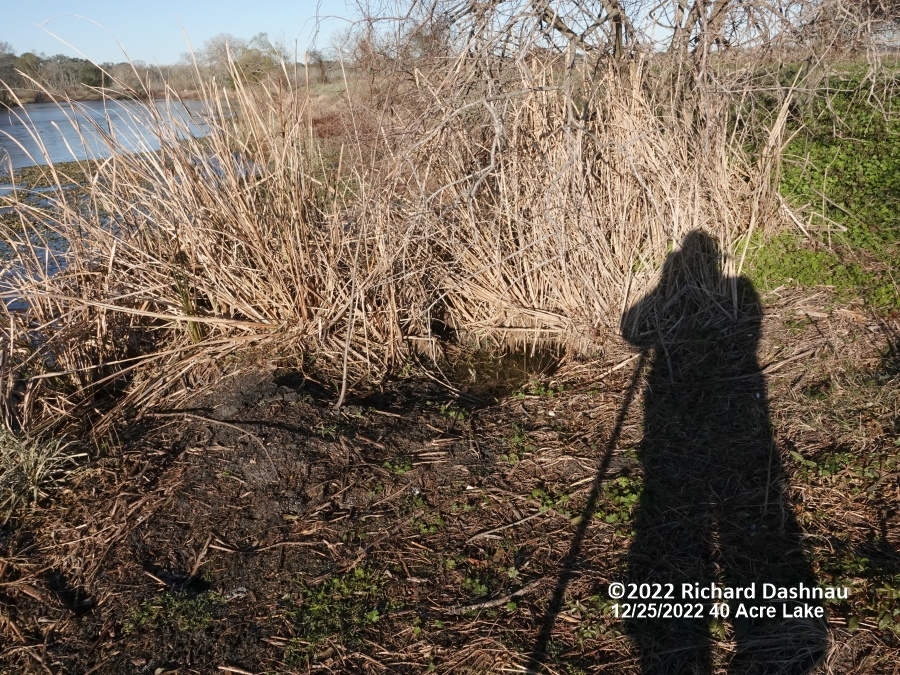
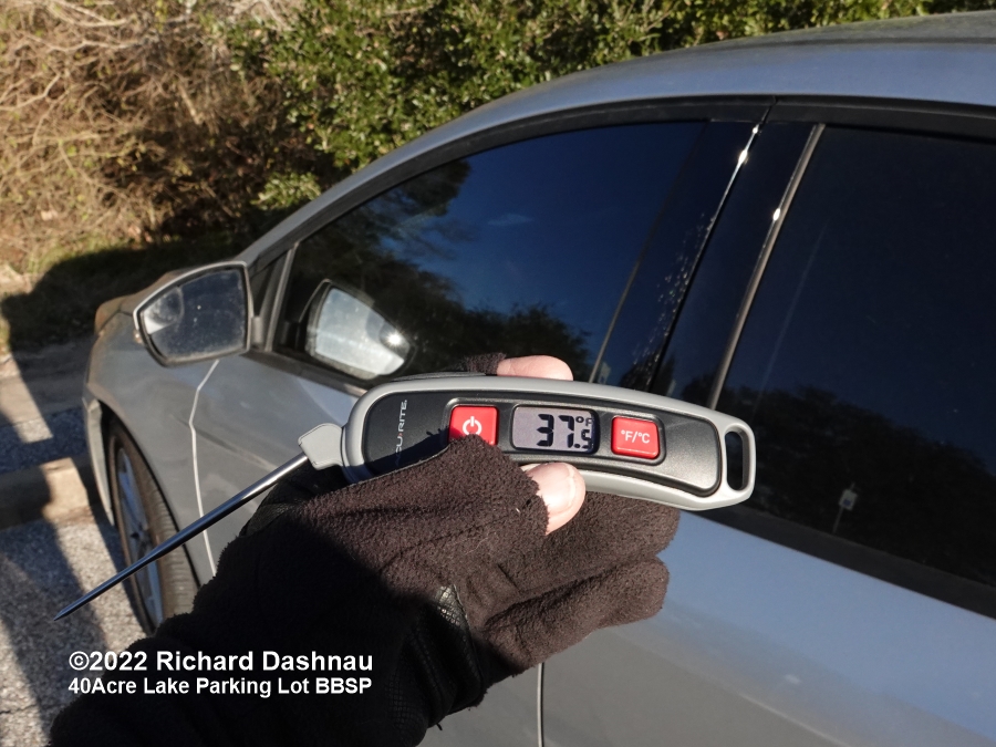
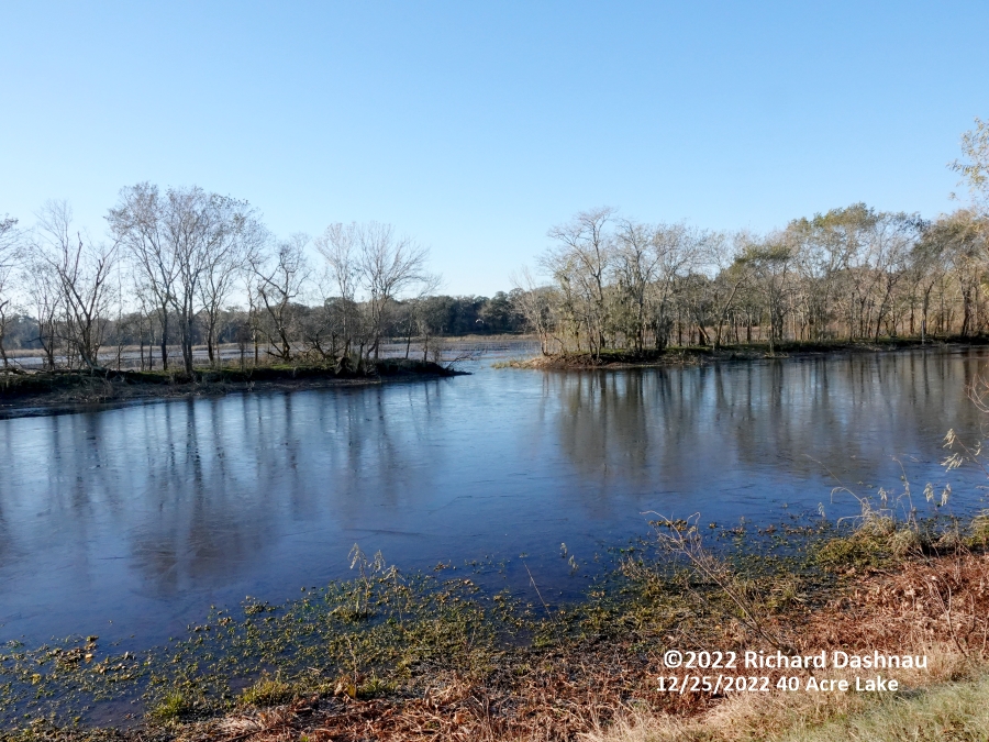
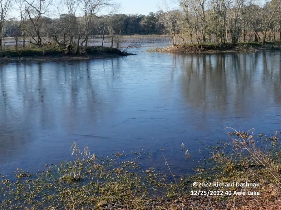
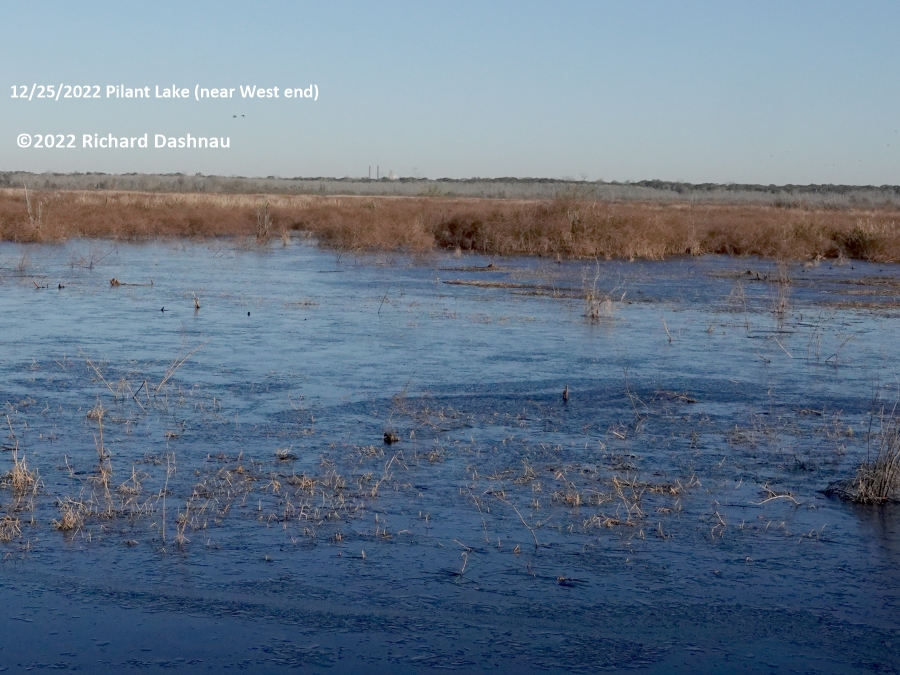
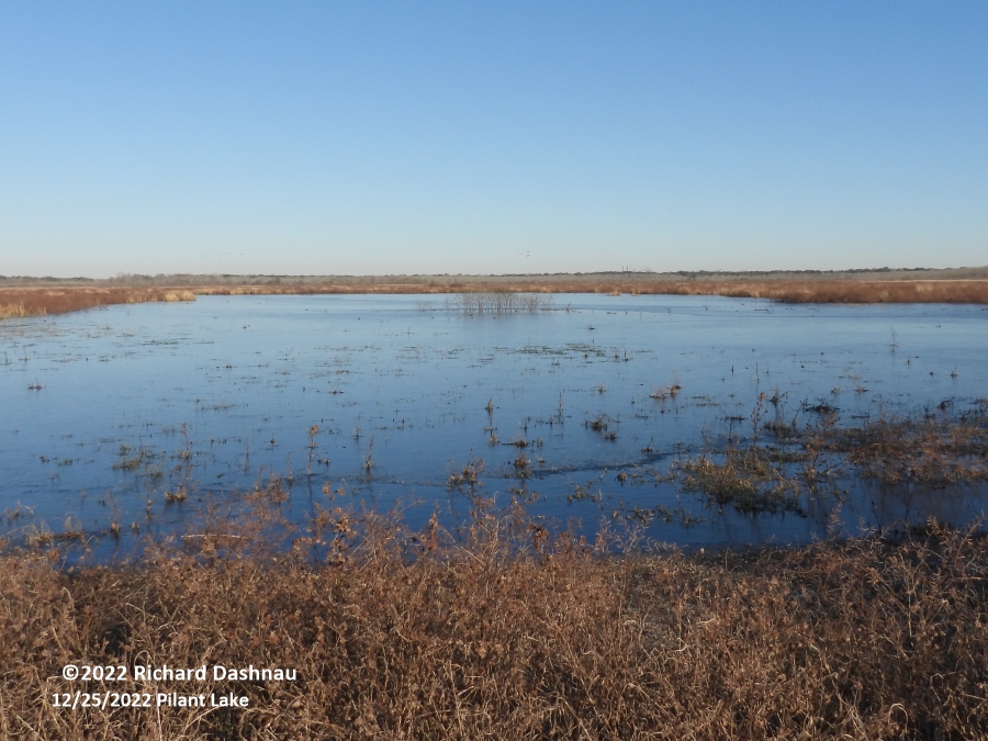
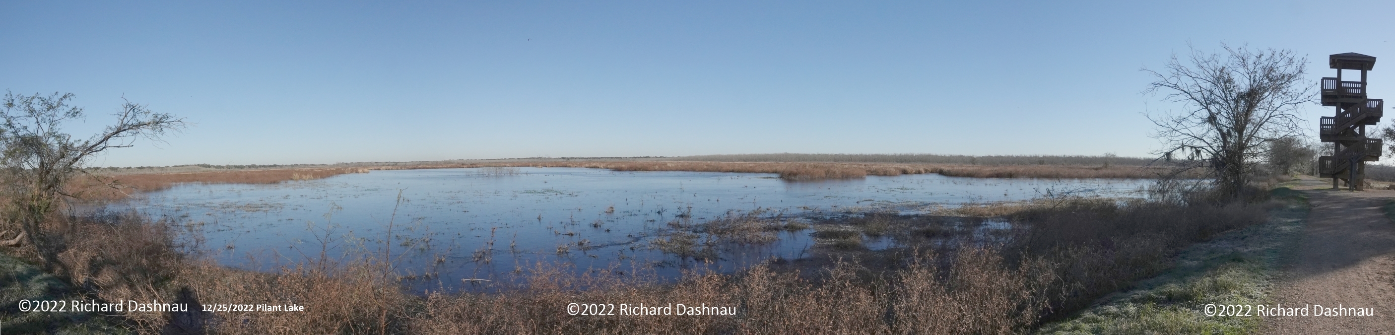
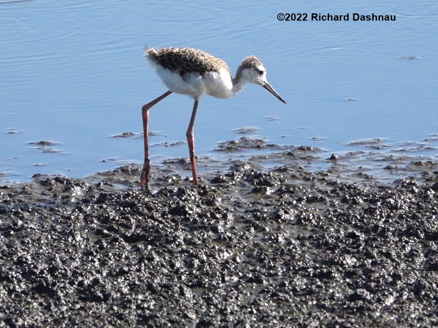
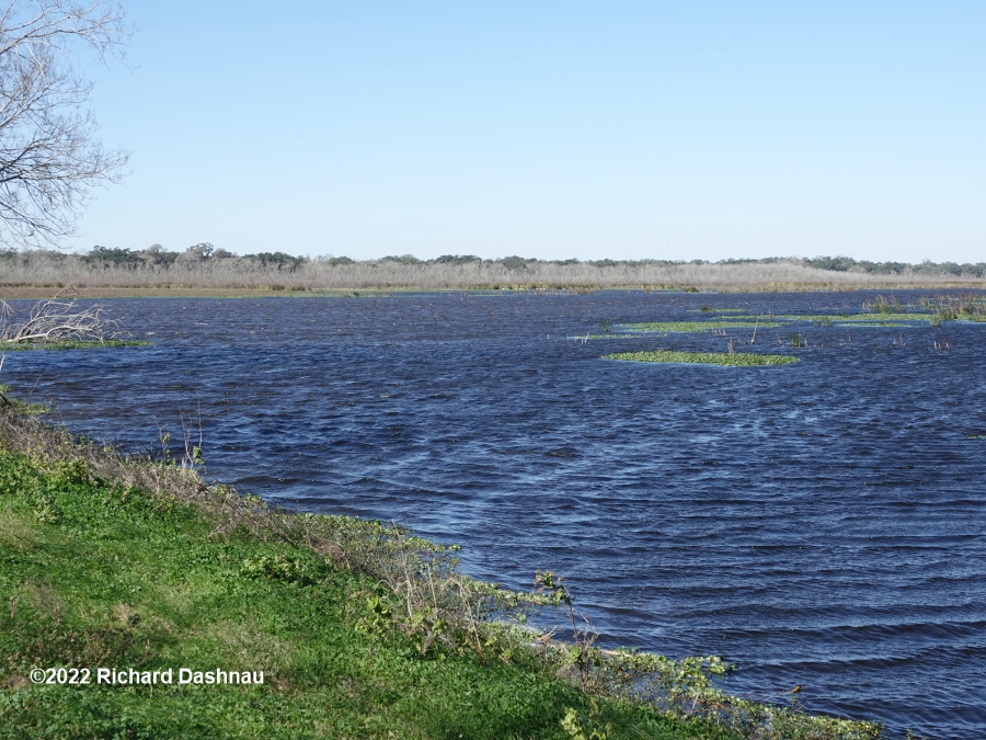
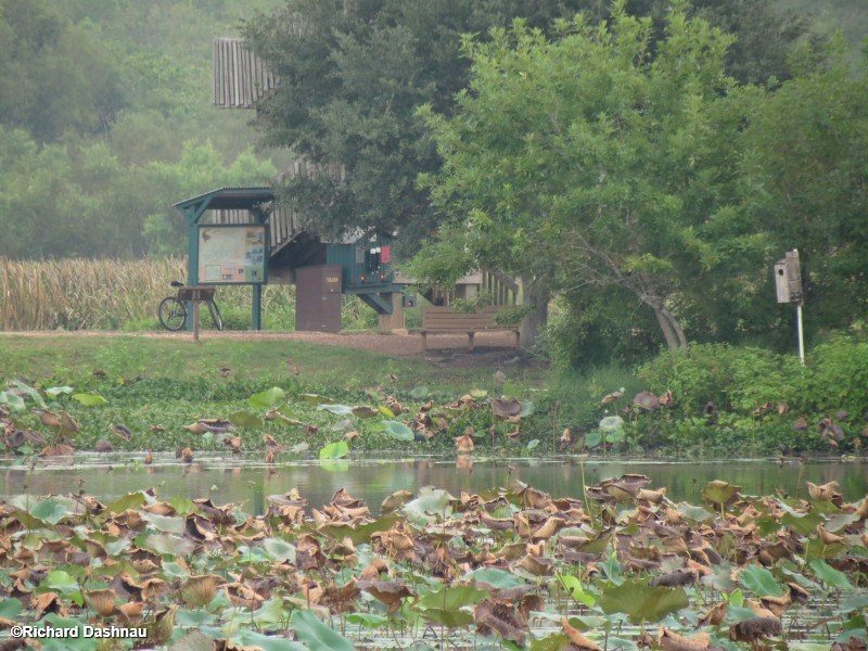
12/25/2022
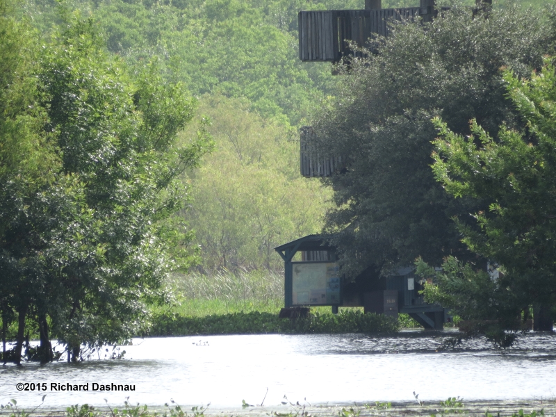
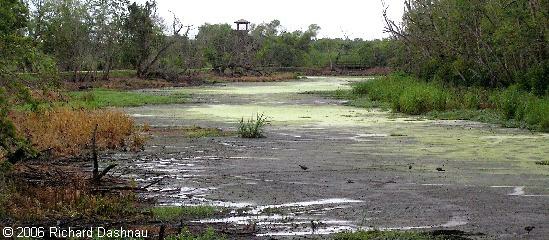
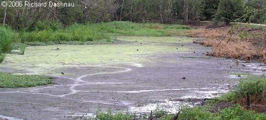
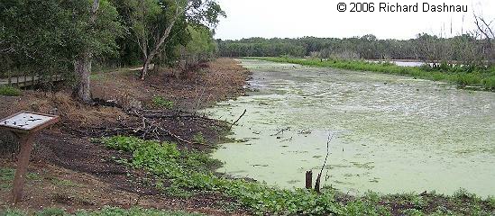
These are images of a den in
40Acre Lake from 2022. They don't show much, but this was
December, after all. Since I'm usually in this area
about 8am, and I'm facing West
for the picture, my shadow is long and dark; and if I'm not
careful, it can fall across the den. Temperature when I got of
out my car was 37°F (15 minutes earlier), so I didn't
expect to see
the alligator (if it was in the den); but hoped to see its
nose exposed for breathing. But it would hide if my shadow
crossed the the den.
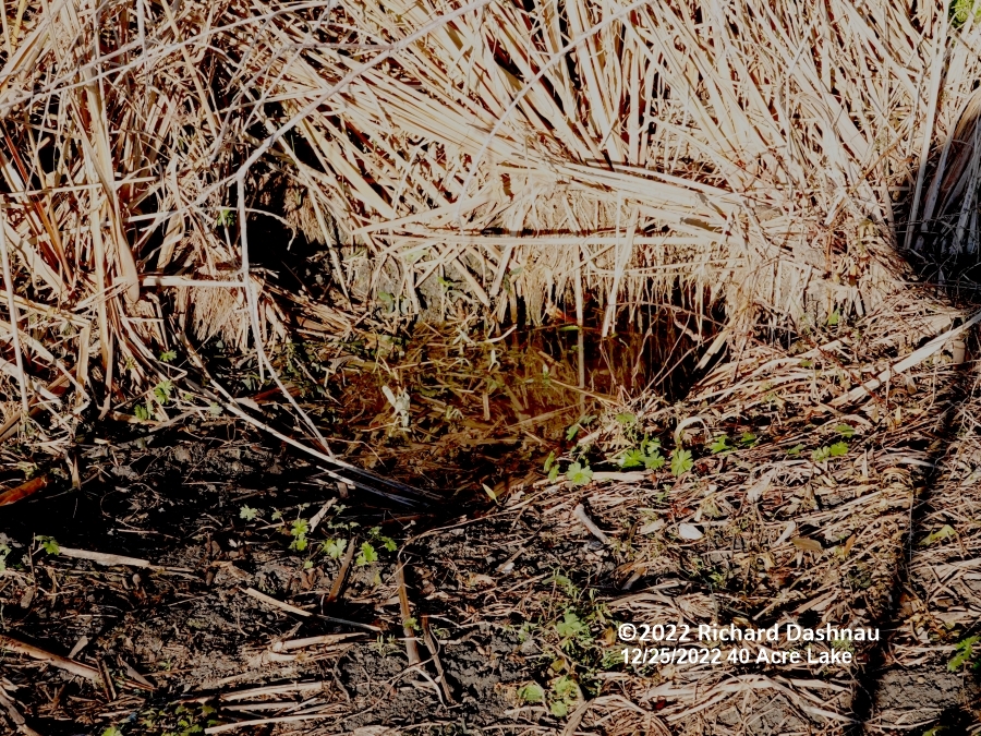
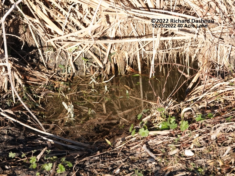
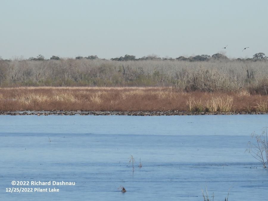
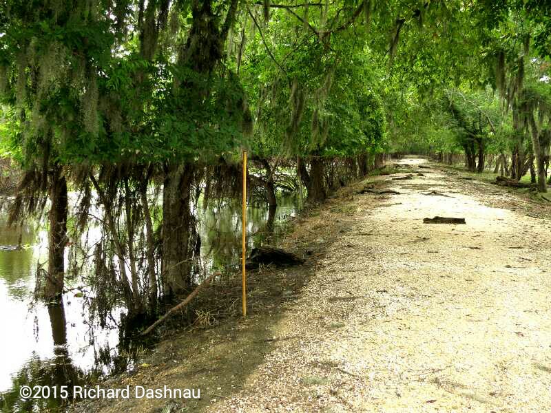
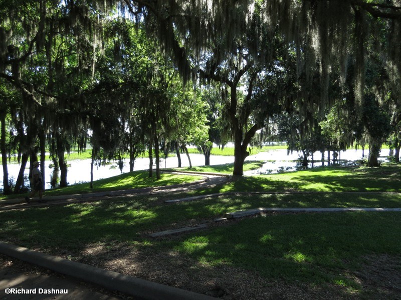
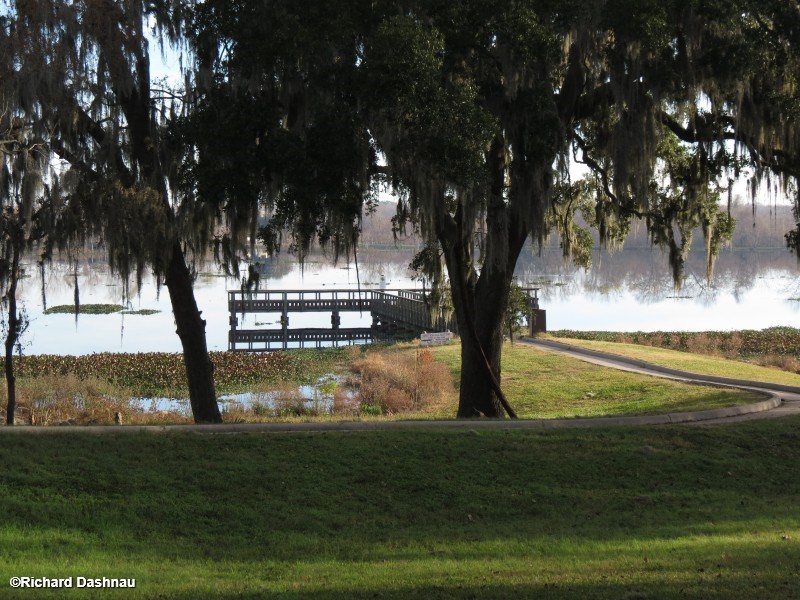
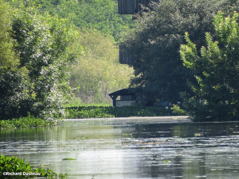
The images
here don't give a full picture of conditions at Brazos Bend
State Park on that day. It will take me a while to format
everything that I observed and captured that day and I
hope
show some of that somewhere on one of my pages (this is a
reminder for me). But the images below will give some idea. All
of them were taken close to 8:30am that day. Note that the
water
in the den opening was...water. But all around it, the water was
frozen. The first two images below show the rest
of 40Acre lake. The third image shows the West end of
Pilant Lake, on the
North Side of the trail (40Acre Lake is South of the trail at
this point.)
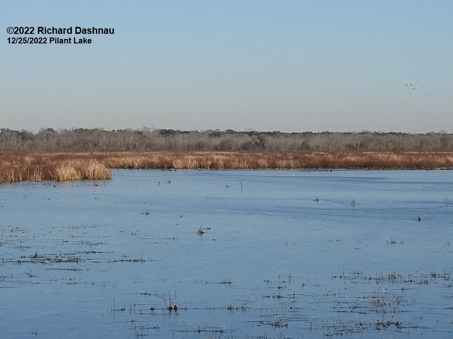
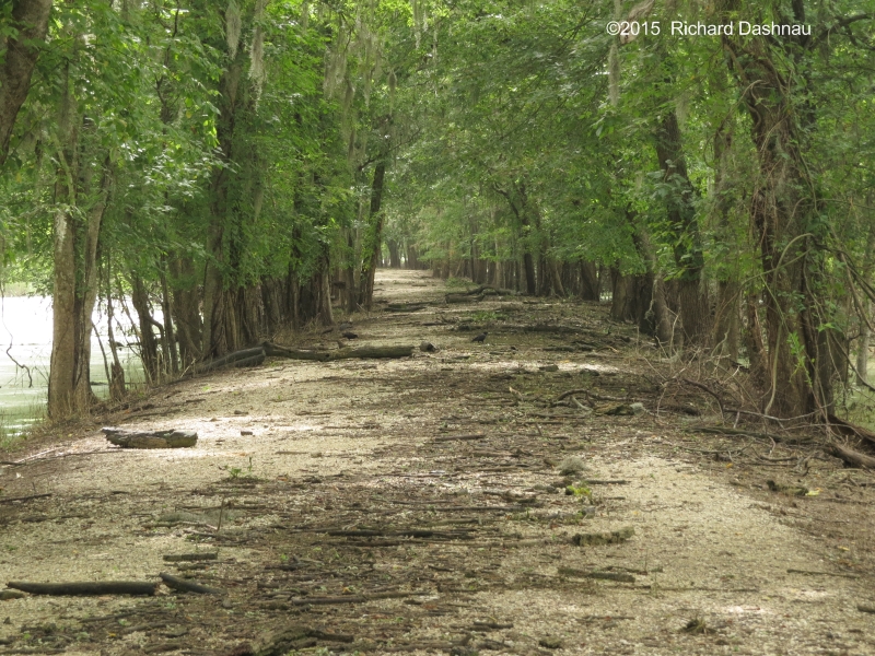
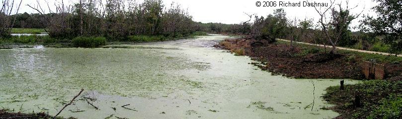
This shows
a wide view of that entire area with the surface all
frozen!
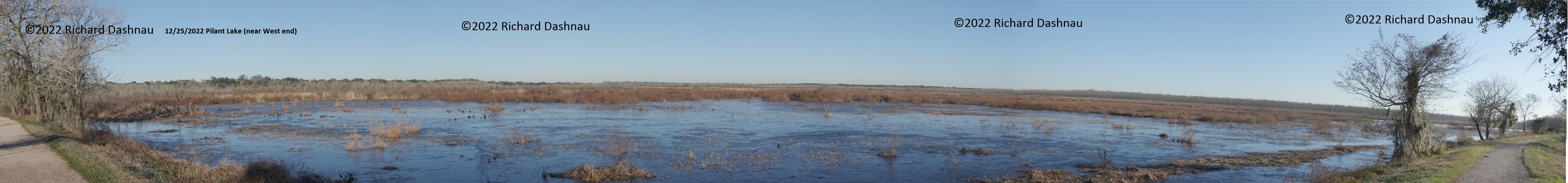
Closer to
the Observation Tower (East of above), ice covered almost all of
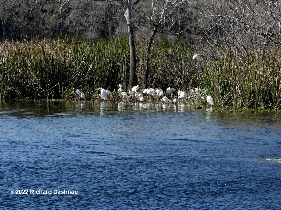
Pilant Lake. But I noticed something at the far edge of the
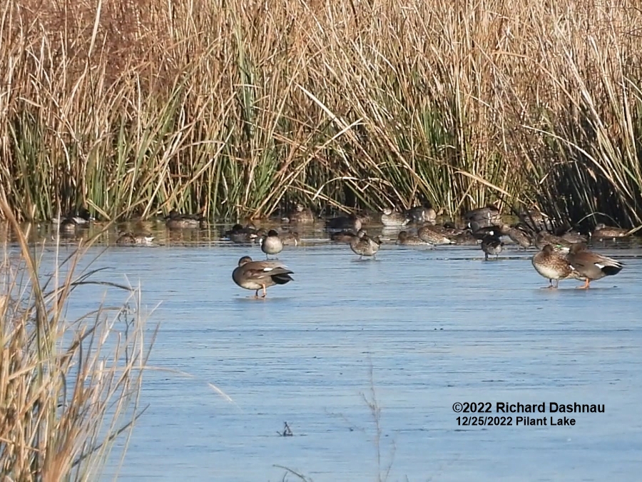
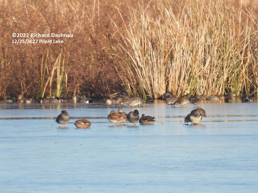
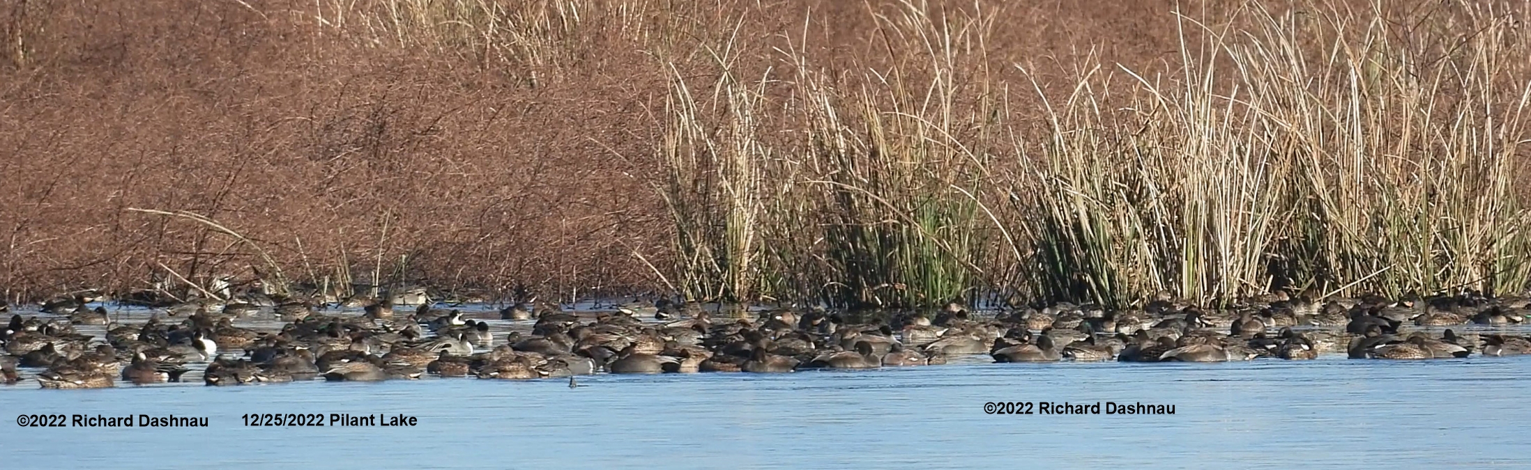
water--about 800 yards away.
I needed optical magnification to see what was going on, and the
images below show what I saw. The fourth image shows ducks
standing on the ice.
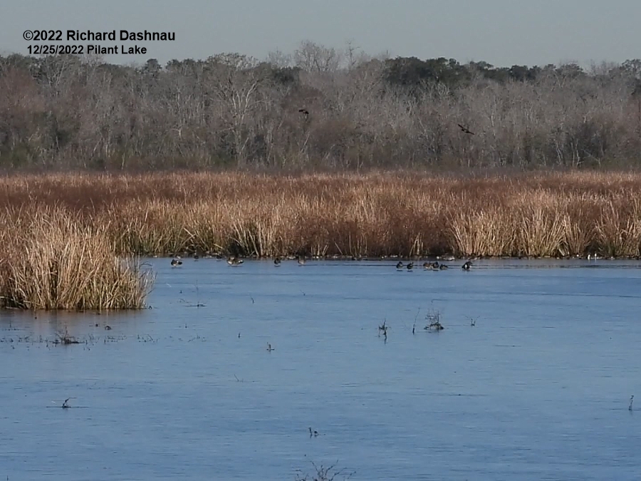
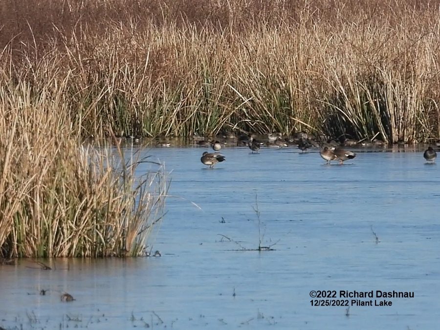
A huge
group of birds was floating in the
remaining unfrozen edge of the lake. If this seems odd
(considering the cold), then remember that the ice is at or
below
freezing (37°F, 0°C),
but
the water is warmer than that. I wonder if that crowd of
birds soaking their feet and legs in the water also had any
effect on the water and
helped keep it above freezing. Whatever the reason, the birds
were there. So, with ice all around, the water in the den
remained liquid. This could be because the
den was excavated into a bank that had good exposure to the
sun. The den entrance-and the bank-gets direct sunlight.
Direct radiation can heat the den, while it
can also be warmed by residual heat from the warmed dirt in
the bank. There was a lot more to see that day (another
reminder for me to put it together).

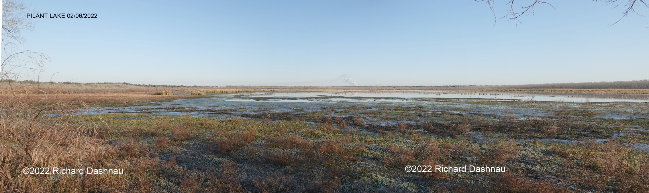
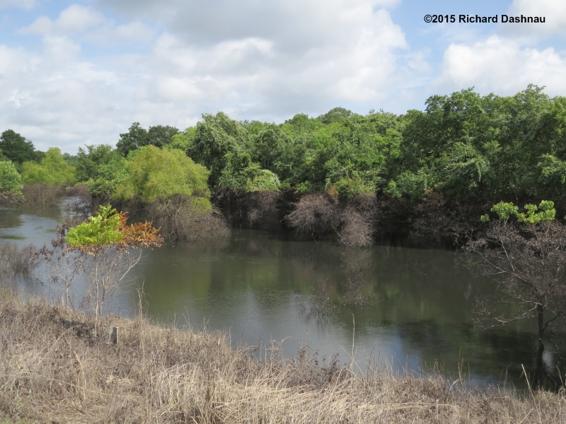
07/03/2022 From Brazos Bend State Park
mostly on 07/03/2022 I'm posting this in
November, after we've gotten rain. I'm using this update to
record some changes in Pilant Lake
starting from February 2022, up to 7/3/2022--which is when I
witnessed the alligator demonstration. Let's go. The picture
below shows Pilant Lake on 2/6/2022. Point of view is a few
hundred yards West of the Observation Tower.
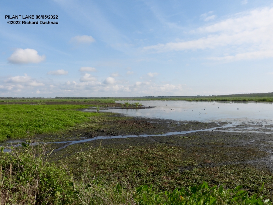
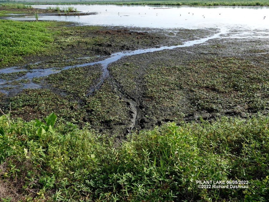
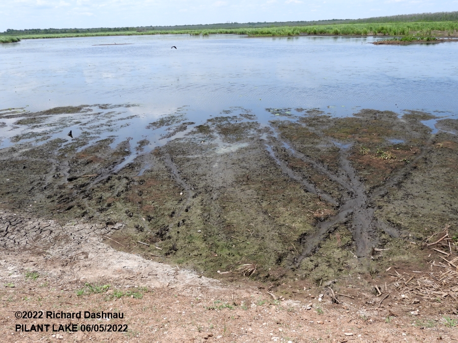
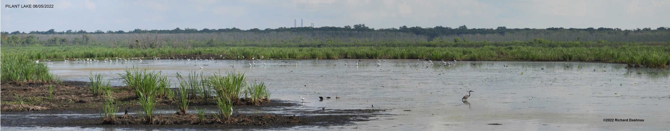
The
pictures below shows Pilant Lake on 6/5/2022. At this time, a
lot of the water had left the lake. The channel running from
the left was partially from the flow of water draining to the
lower
area, and partially from alligator traffic. The second picture
clearly shows the drag marks and footprints of at least one
gator. The third picture was taken later in the day, after the
activity
that was going on in the background of the first two images,
and the gators left the lake. The long image below those
two shows what was visible in the background of the two
images.
I've already described what was going on back there on one of my other web pages.
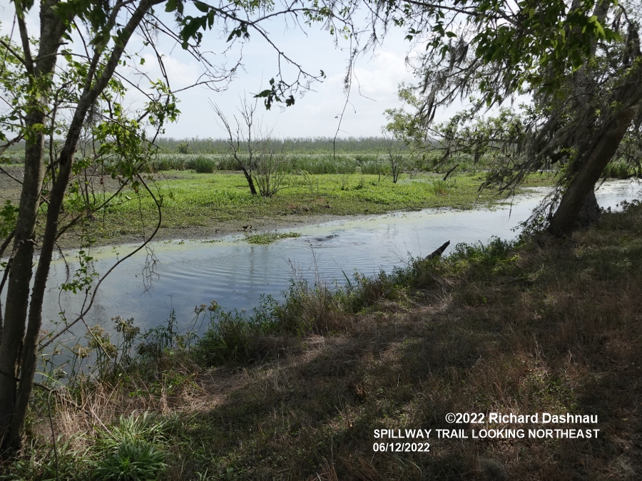
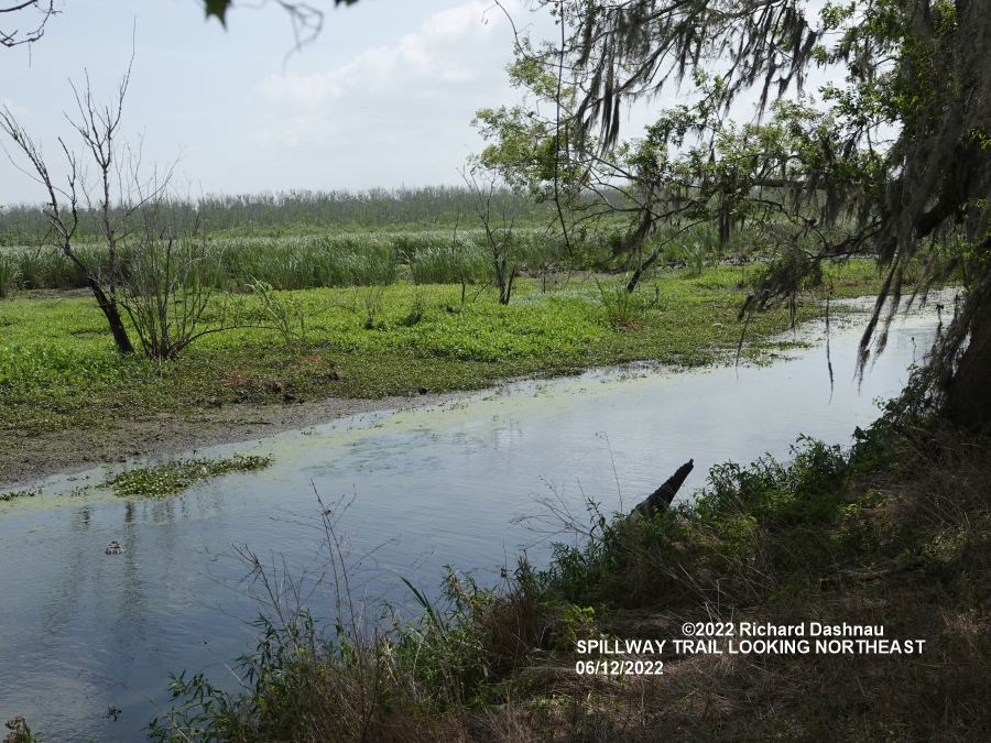
The first two pictures below are from a week later,
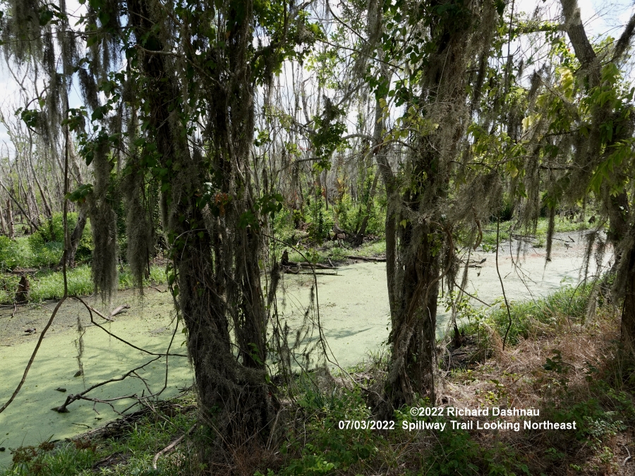
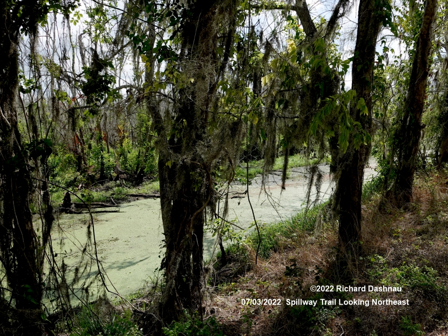
06/12/2022. This is about halfway down the Spillway
Trail, West of the Observation Tower. The area to the North,
usually submerged was
getting growth, while the remaining aquatic life was in the
water near the trail. The second two pictures show
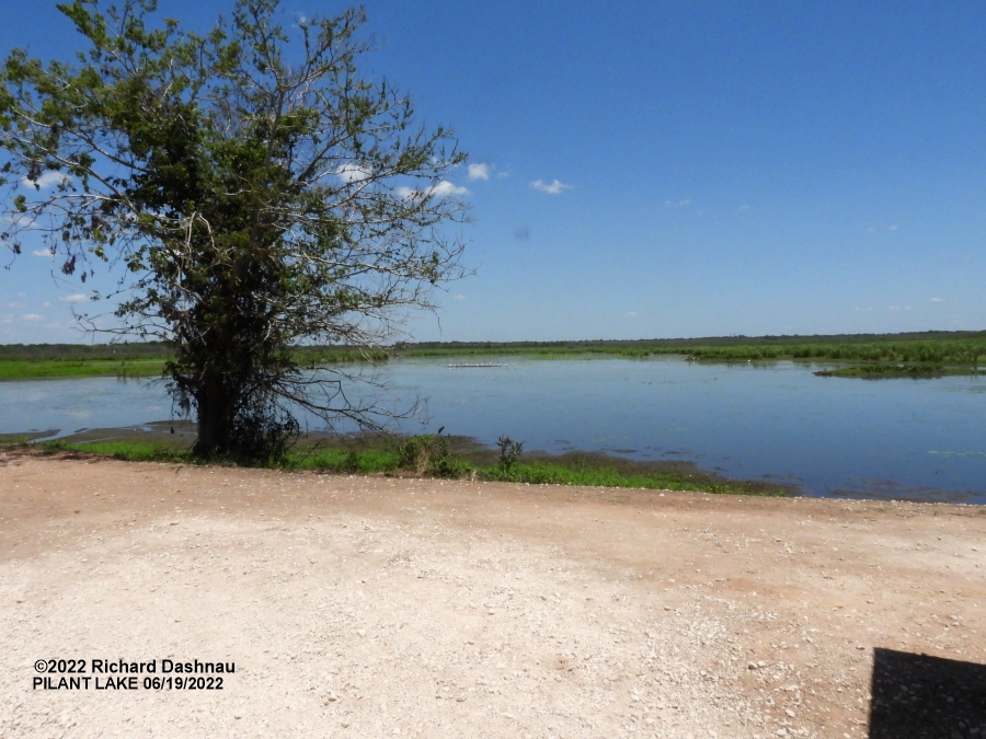
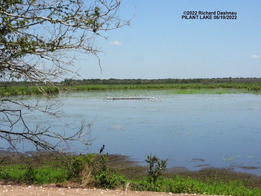
Pilant Lake on 6/19/2022. There's water there in
mid-June, but it continued to
go away. The surface of the water was bare, and
there were few alligators visible. There were some birds
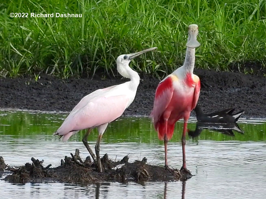
foraging on the mud flat in the center, mostly Roseate
Spoonbills. The Spoonbills
were there because many had hatched on the West end of Pilant
Lake.
Now--we are at July 3, 2022. Over the course of the year (I'm
writing this in November) we watched the lakes shrink until
mid August. Many people asked what the alligators do
when they
lose a lake, or where they go when they leave a dry lake.
Trenches were visible when things were totally dry--but
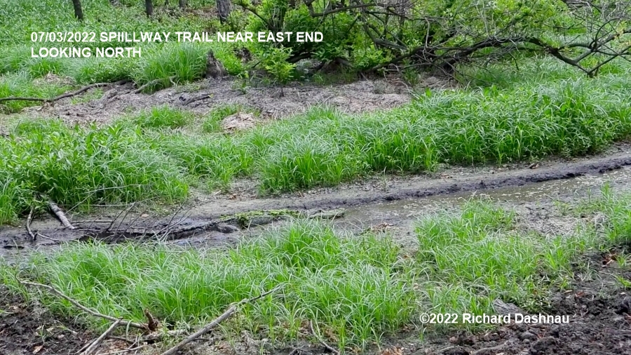
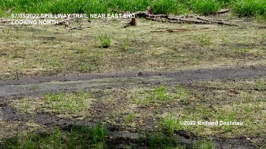
by they hadn't gotten that bad this week. The North side of
the Spillway Trail
had some water remaining near the Spillway Bridge, but it
turned into a morass of muck as one moved East. The two
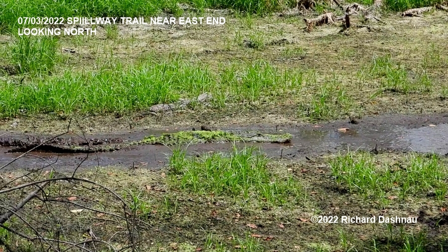
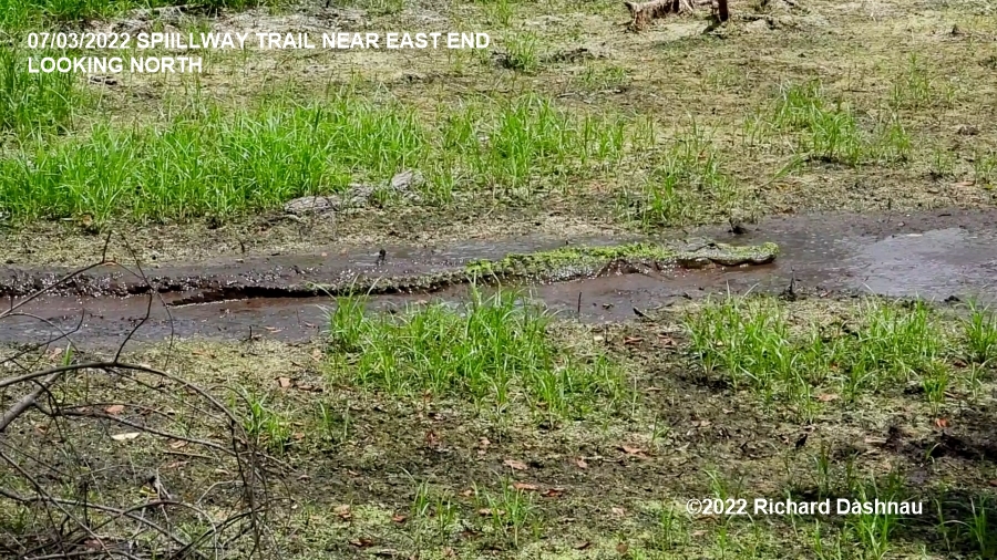
images below show the low water about halfway down the trail.
There
were
still a few alligators along that length, but some of them
were not friendly to each other. I followed one that had been
chased East.
It moved through the deep muck, pushing a blob of
water and mud in front of it. There is also video of
this interesting movement
at
this link.
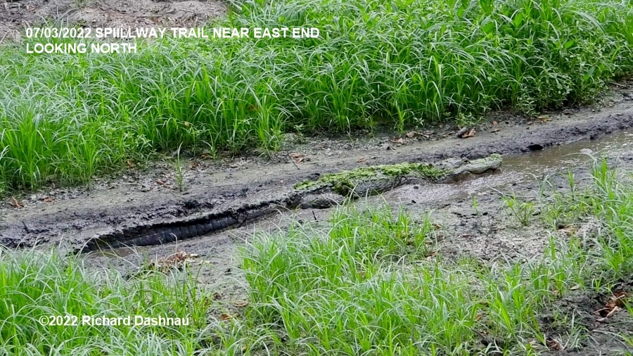
It moved by using a walking/sliding gait. Occasionally
it lifted a leg out of the mud to take a step. It continued
walking at a "trot", with rear leg on one side and front leg
on the other moving
forward for each step.
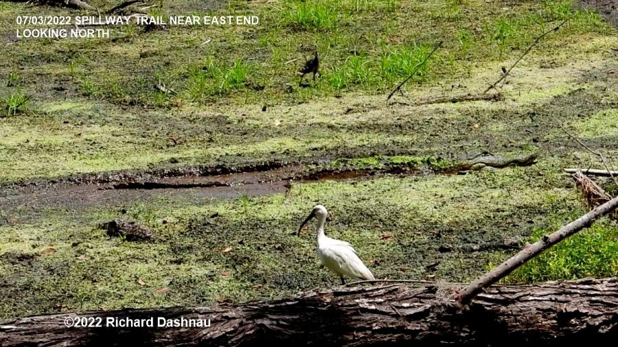
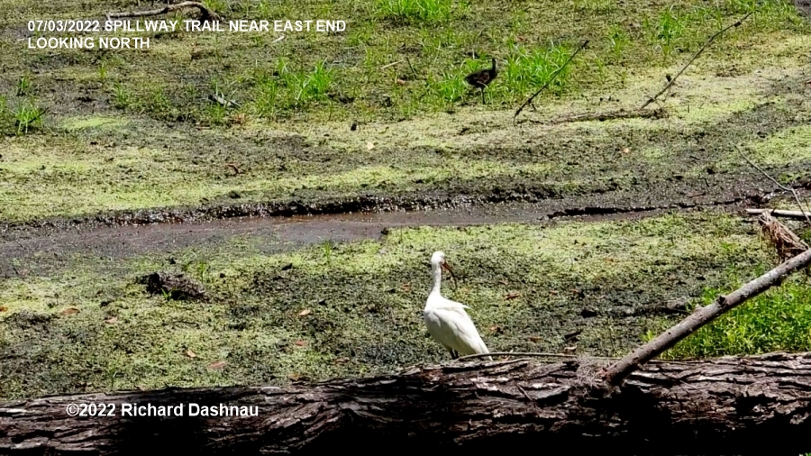
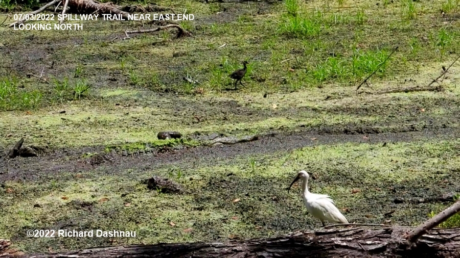
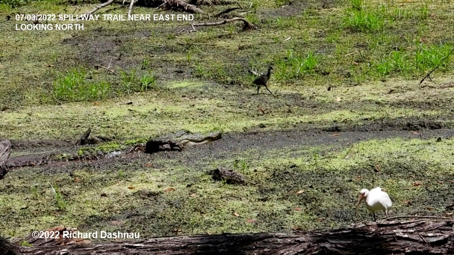
A young Gallinule and a White Ibis that had been foraging in
the mud moved back as the alligator pushed by. Even when apparently
mired in a morass of mud; an alligator can still move fast
enough to grab prey if it is close enough. The middle
picture shows the blob of water that moved ahead of the
alligator. At first glance, it appeared to be a current
or flow, but it was entirely
being pushed by the alligator.
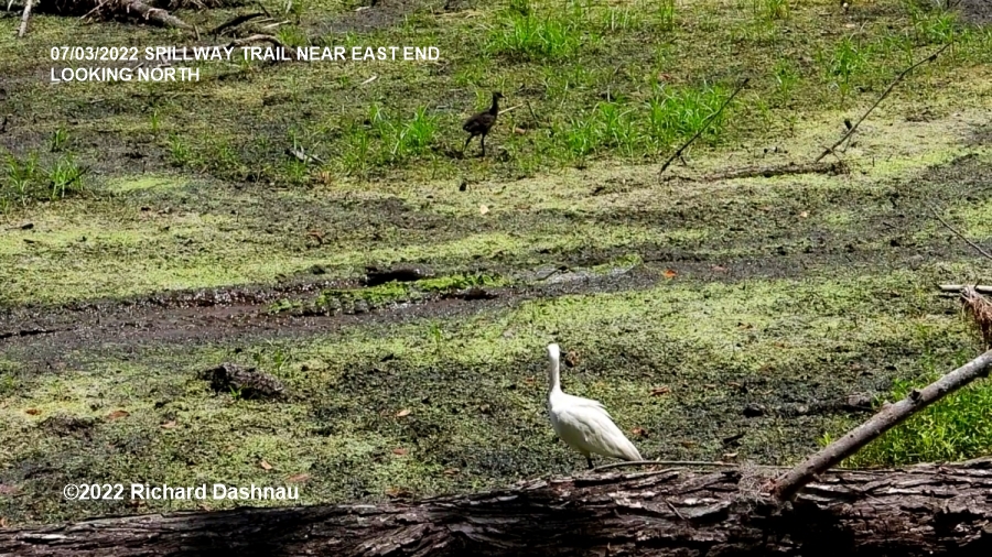
The last two images show that the level of mud behind the
gator was lower--demonstrating that it was the force pushing
the liquid. The alligator made it to the far end of the trail,
where there
was a deeper area in the corner where the Spillway Trail meets
the Elm Lake Trail. How many other alligators must have
taken the same route, and formed that trench?

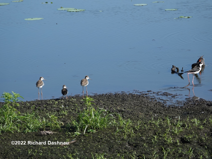
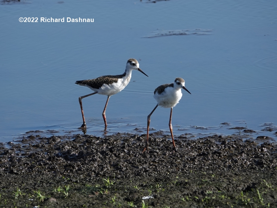
If it seems depressing to see
the water levels dropping...well, it was. But these birds were
also foraging in and around Pilant Lake on July 3rd, and that
was fine; so I'm including the images
here. There are some short video clips that show their
activities also, which can be seen here. When the mudflats
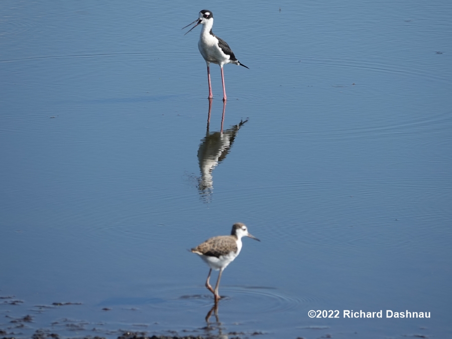
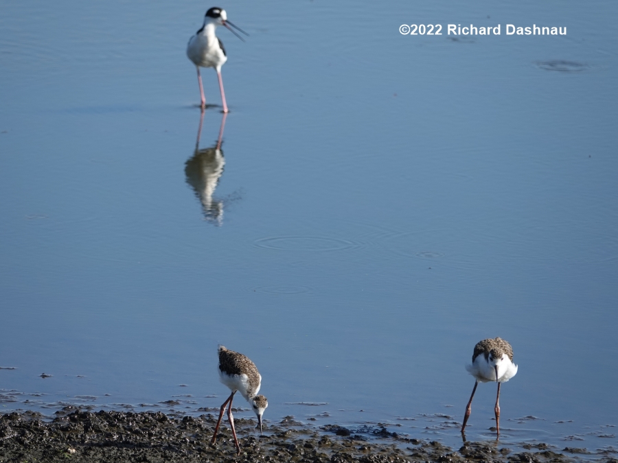
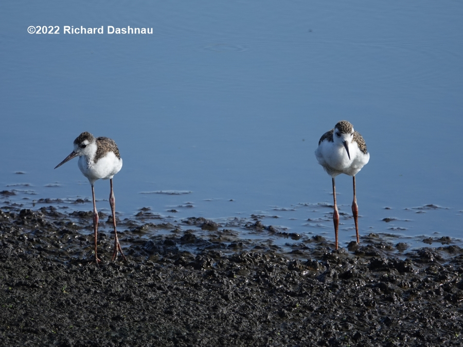
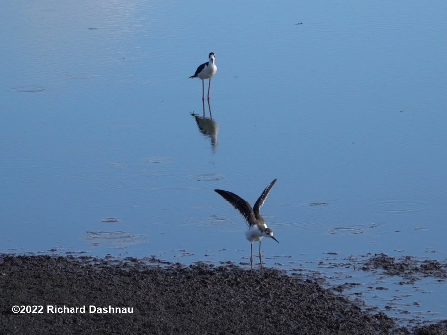
formed from the shallow water, we had many Black-necked Stilts
come in, and
some nested at the the lake. This is an adult with chicks.
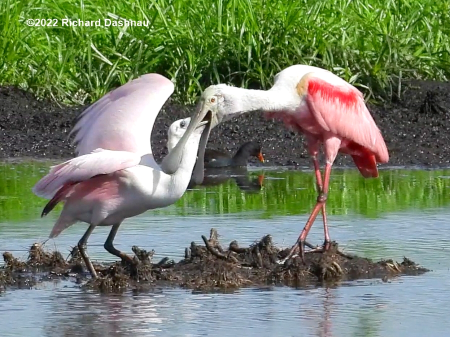
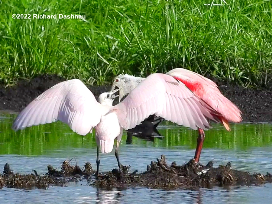
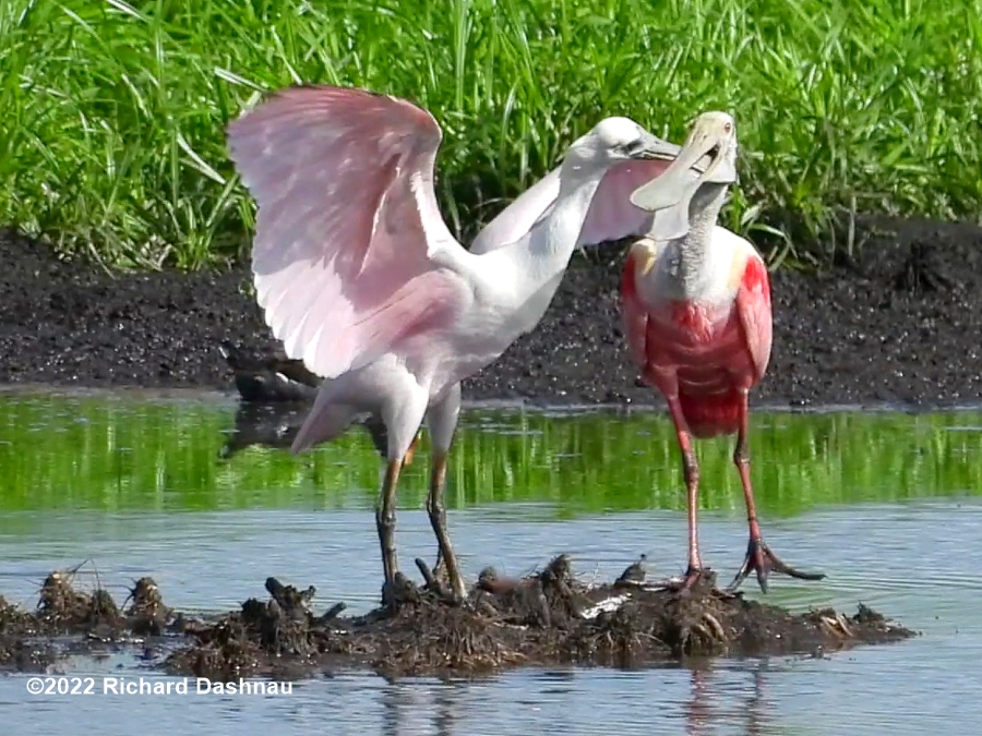
We'd
had many Roseate Spoonbills nesting in Pilant Lake this
spring. By this time, the juveniles were large, but they still
begged to be fed by adults. This Juvenile was with an adult on
an
exposed mudflat island. The juvenile bobbed its head when
approaching the adult, and if the adult stood still long
enough, the youngster poked the end of its bill at the joint
of the adult's
bill. Sometimes, it was fed.
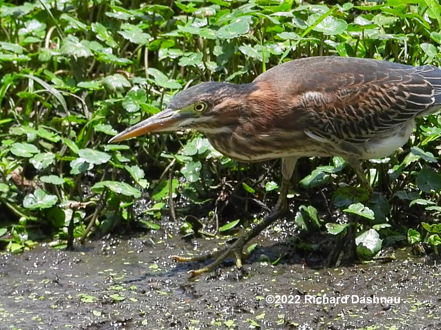
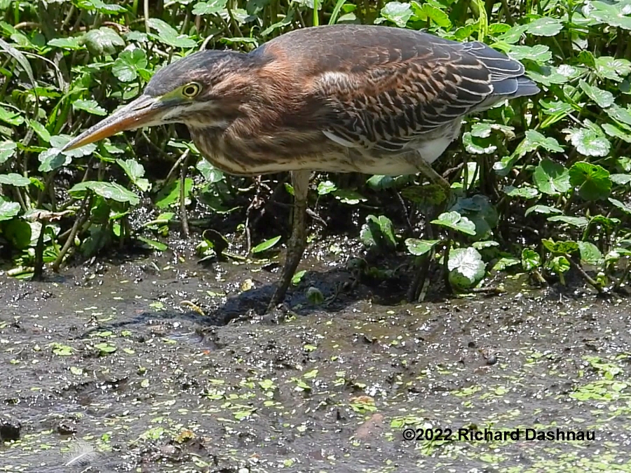
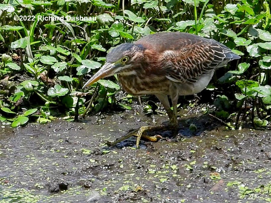
This
Green Heron was hunting in the water along the Spillway Trail.
These three images show its feet sinking into the mud.
The mud had only been exposed a week or so, which is why
it
was so soft.
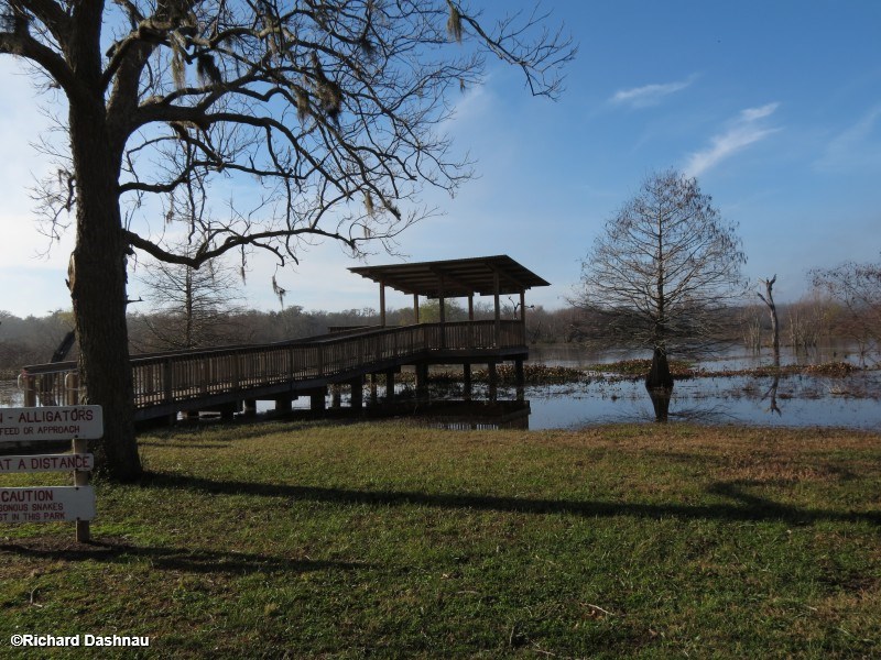
01/02/2022
A
cold front came through our area on the evening on January
1st, 2022. The forecast said that temperatures would be
somewhere in the 30's F (or about 40ï°F
colder
than the day before).
I went out to BBSP again on 01/02/2022
mostly for two reasons. First, I'd seen Bald
Eagles out there (or the same one more than once) the
day before. One of my
"working theories" is that our favorite winter predators
(Eagles and Otters) would be more active on cold
mornings because they're require more food for fuel.
Second, I wondered what the pod of baby alligators would do in
the cold, and I also wondered how much the air temperature
would differ from the temperature of the water. So, I
went out. In spite of the cold, and wind, it turned out to be
an interesting day.

Finally,
a few more comments about the wind. For a while, it was
powerful, and with the air below 40°F,
it was quite chilly out there. When I'd first reached
Elm Lake, the temperature
difference between the air and the warmer water allowed mist
to form and move gracefully with the wind, and I tried to
capture that on film. Most of the birds had sought
shelter, and
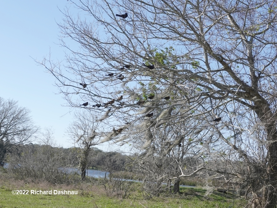
were clustered in various places of cover along Pilant and 40
Acre lakes. They were looking for still air. I saw a
flock of birds in a tree and all the birds were facing into
the wind.
Anyone interested in hearing what that wind sounded like, I've
got a short video
here. I went in to the Nature Center and work a
shift.
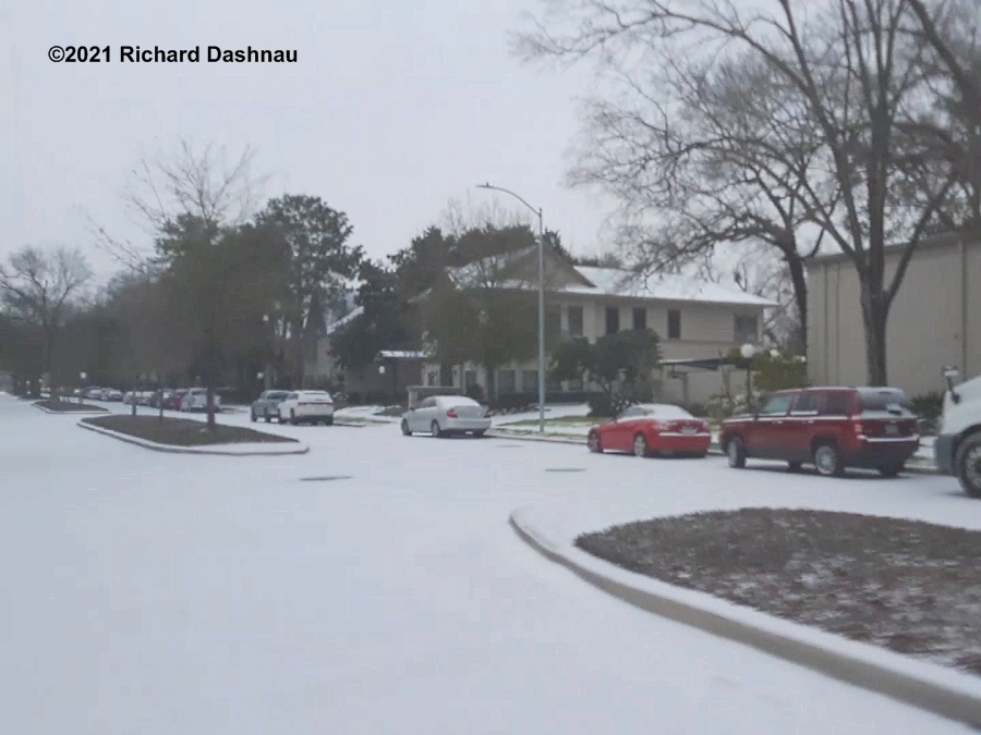
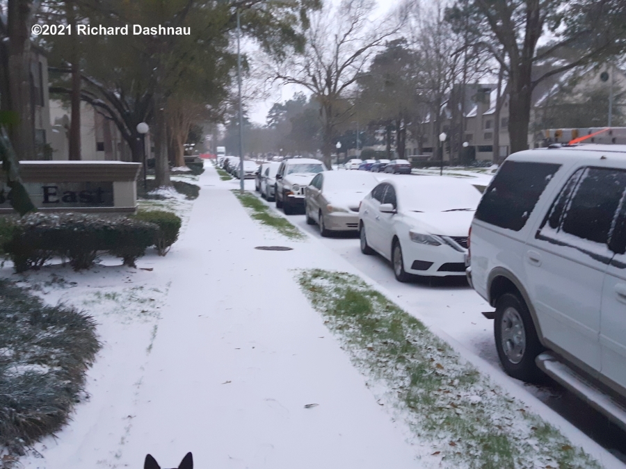
02/14/2021 - 02/20/2021 and after... The
world has been dealing with the effects of the COVID-19 virus
for a year. This week, a Polar cold front swept through
the entire
state of Texas, causing temperatures to go below freezing for
about a week...and below 15 degrees for the first few days.
Apparently the networks that deliver electrical power
to the entire state were not prepared for such cold--and a
large percentage of them crashed, causing blackouts through
most of the state (these events are well-documented elsewhere-
that was just a summary of the background.) Now, here's
how it affected ME. In brief:
1)
2/15/2021 (Monday)--Apartment power went off about 1:30
am. It stayed
off , through 2/16/2021 (Tuesday).
2) 2/17/21 (Wednesday) Power came
on at 6am. Power went
off at 7:50am. Power came
on at 11:45am. Power went off at 1:00pm . Power
came on at 2:30pm. Power went off 8:45pm.
Power on at 10:49pm--and stayed on.
3) 2/18/21 (Thursday). Although power was on, city water
was not, and apartment heat was still off. Heat came back on
at about 4pm.
For those first few days, Houston was very, very different.
NO sounds at all. No traffic because ice had closed the
roads. No heat. No light at night except for alternate
sources.
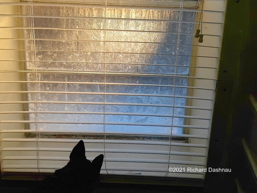
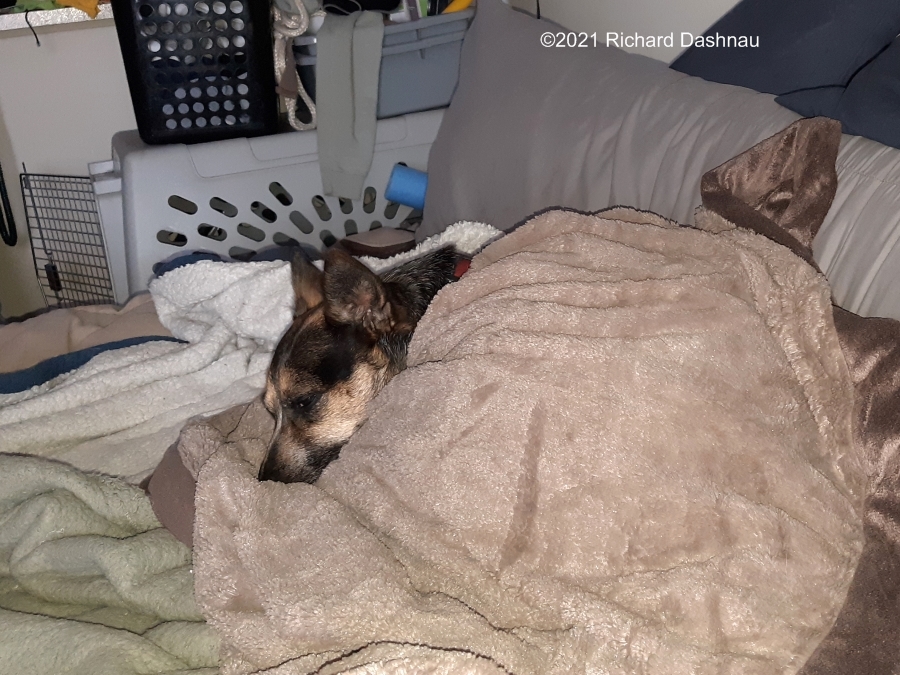
The images below show what it was like for me and Piper, my
dog. At sunrise on the 15th, we went out as usual (boy,
was it COLD). Our footprints were the first in the snow
on most sidewalks.
Piper seemed unimpressed.
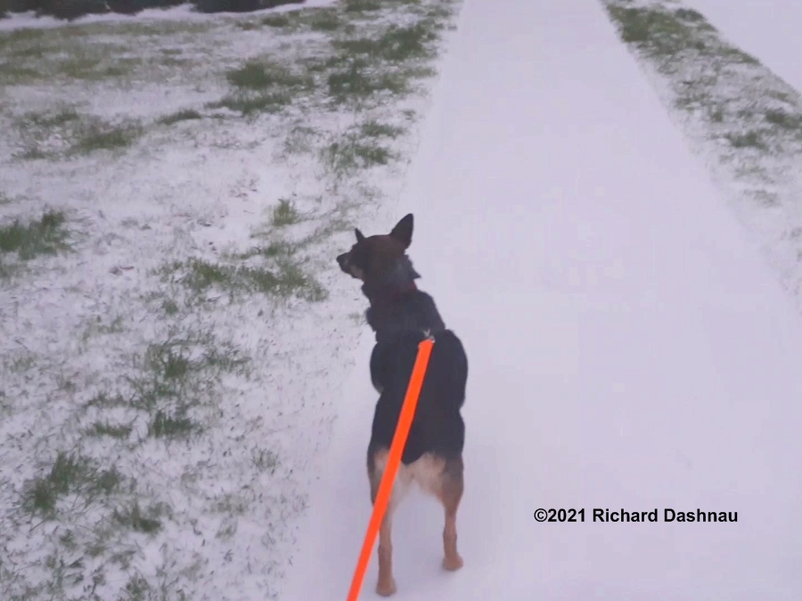
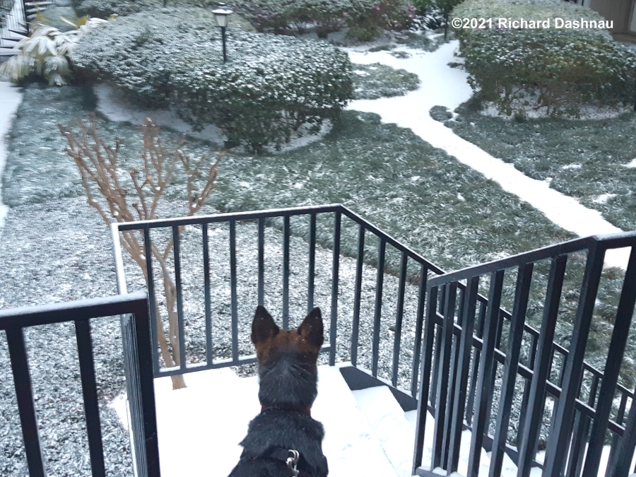
The images
below show what it was like for me and Piper, my dog. At
sunrise on the 15th, we went out as usual (boy, was it COLD).
Our footprints were the first in the snow on most
sidewalks.
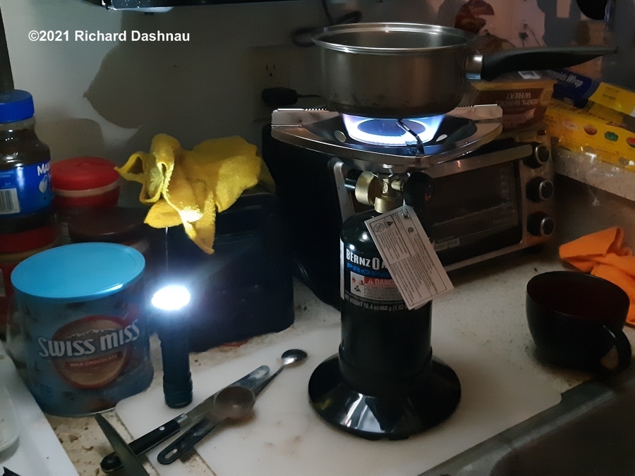
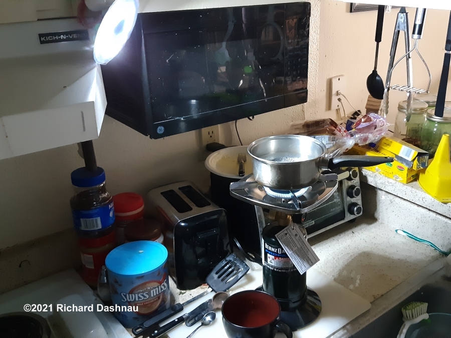
Piper seemed unimpressed. Back inside, I used my Coleman stove
to heat food. Since there was no power in the area, my
cellphone service was mostly gone, too--no data for sure. But,
I had a
very small television that ran off batteries. So, I could at
least watch news on a few channels to see what was going on
outside. Later, I hung my dissected Luci light in the kitchen
for better light.
I listened to music on mp3 players, read books, and that's
about it. I ran my car for an hour each day to allow it to
warm a bit. I used that time to charge any devices that had
low power.
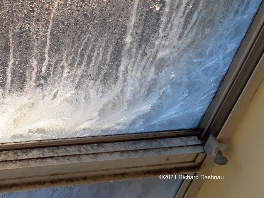
At sunrise
on the 16th, we went out as usual (boy, was it STILL COLD).
Air inside the apartment was about 40 degrees F. I had
ice on my windows.
Piper remained unimpressed.
I used various battery-powered and solar-powered lights when needed. This was the Luci solar light.
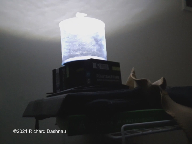
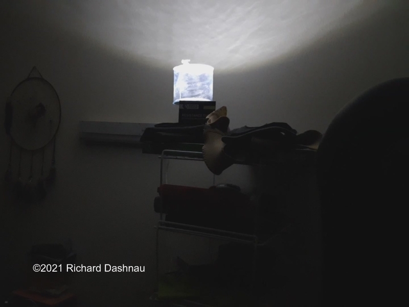

This is a quick demo of the lights I could use. Here's the video (mp4).
08/25/2017 -- 08/28/2017 and after... It
is National news that Hurricane Harvey hit Texas, and flooded
Houston. Images and videos can be seen everywhere. But I
live there, and this is my
website; so I'm posting some of my own material here. As I'm
writing this-9/28/2017-Houston is recovering, but it will take
years to come back. I was fortunate this time, but many people
I
know, neighborhoods I know, and real estate that I know---were
covered and damaged by water. Things are far from "normal"
here.
So, like many others here, my place of employment closed early
Friday, August 25th, to allow us to prepare for the arrival of
Harvey. From the time I got home, through the next few days, I
watched the progress of the storm via our local news stations,
and monitored via my phone.
8/25/2017 (Friday)--- 8/26/2017 (Saturday)
Raining at 9pm Still Raining at 10pm and Still Raining at 11pm and Raining at 12am next morning
I finally got too tired, so I went to bed. On waking up the next morning (Saturday), there was more rain...continuously falling.
8/26/2017 (Saturday)--

Raining at 5:30am Still Raining at 7am and Still Raining at 10am and Raining at 1:30pm that afternoon.
The local
news stations had already begun issuing flash-flood warnings
and high water alerts. The authorities all recommended that
people
stay off the
roads. I stayed in, and watched the news and my phone. I
did use the occasional break between rain bands to take the
dog outside.
8/26/2017 (Saturday)--
Raining at 5:30pm Still Raining at 7pm and Still Raining at 9pm and raining at 11:00pm that evening.
The local
news stations had already begun issuing flash-flood warnings
and high water alerts. The authorities all recommended that
people
stay off the
roads. I stayed in, and watched the news and my phone. I
did use the occasional break between rain bands to take the
dog outside.
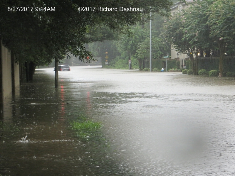
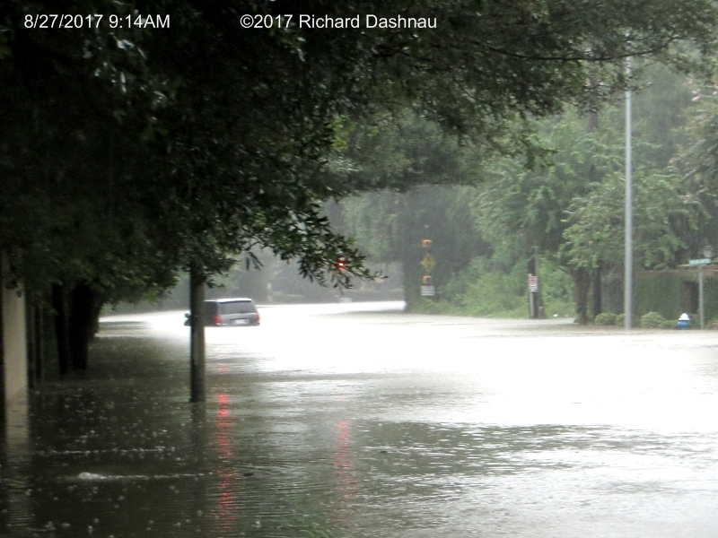
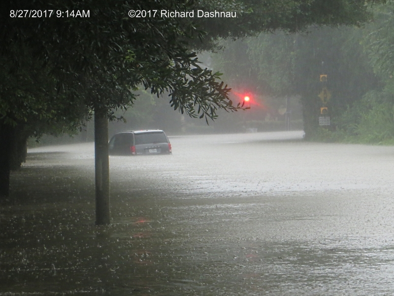
8/27/2017 (Sunday)--
Raining at 4:30am Still Raining at 12pm and Still Raining at 1pm
Now into
the third day and evening of rain. It just kept coming. But on
the 27th, I went out to check on Buffalo Bayou, which flows by
about 1/2 mile away from me. When I got to the bridge that
crosses the bayou, it was clear(though the water was at the
top of the
bridge). But about 100 yards South, the road was covered by
water. There was a van partially-submerged. And it was still
raining.
I filmed some video as I turned and walked back to the bridge.
Sound is bad because water got into the microphone, but it
shows
the water up to the bridge as well. The video is
here. I returned home, and stayed inside to watch
the news as it showed Houston--the city
that is my home; and the surrounding area--being flooded.
8/27/2017 (Sunday)--
I
went out to the same place again on the next day. The
water level had lowered, leaving the van exposed. But the road
beyond the van was still
flooded, and two more cars were trapped. As I type this now, I
wonder if they'd been there all along, but had been totally
submerged and hidden
from sight before.
8/28/2017 (Monday)--
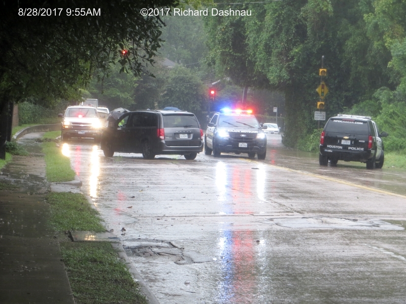
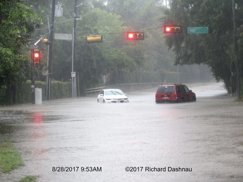
One the
next day (Tuesday) water level had lowered even more. While
this was a good sign, there were other parts of Houston (and
around
the area) where the water was still rising at this time. The
ruined car remaining at that intersection was a minor example
of the great
ruin that was revealed as the water receded.
8/29/2017 (Tuesday)--
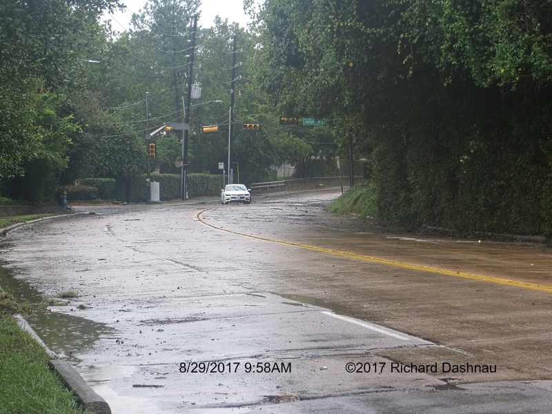
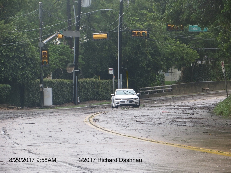
On
Wednesday, I rode my bicycle to my place of employment (about
30 minutes one way) because I wasn't sure of road conditions.
Luckily that property was also not damaged, so I returned to
work on Thursday. However, large parts of the Houston Metro
area
hadn't even begun to repair. The next weekend, (Sept. 2 and 3)
I helped out at one of the local businesses--helping receive
and organize
flood supplies (mostly cleaning chemicals). The employees of
that business did the dispensing of the supplies. I worked
there on the following
Saturday (Sept. 10) also.
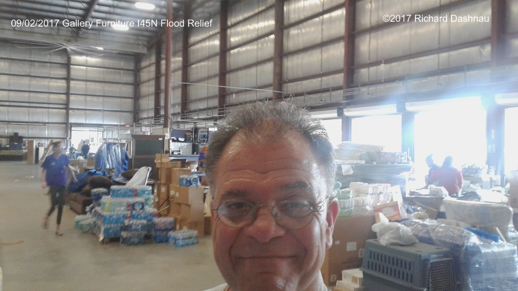
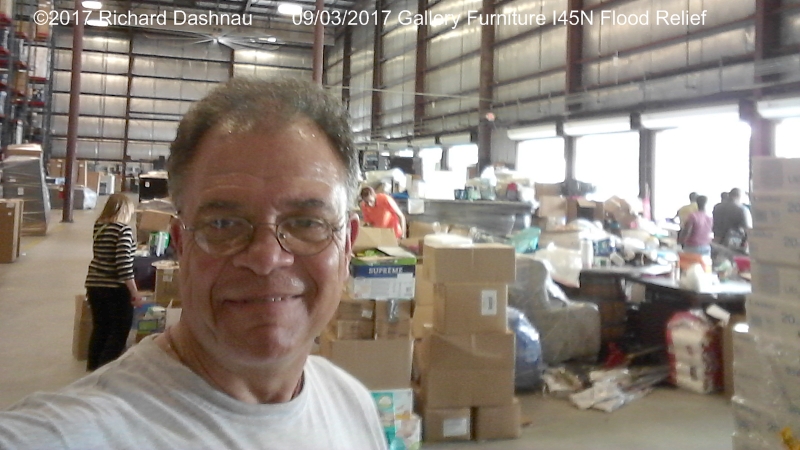
Helping give out supplies Sept.2 Helping give out supplies Sept. 3
While I was
working there, I could see the many faces of those who'd lost
so much, coming to take what they could. While this was
was sad, I was uplifted by seeing the people who were helping.
I met this group of people:
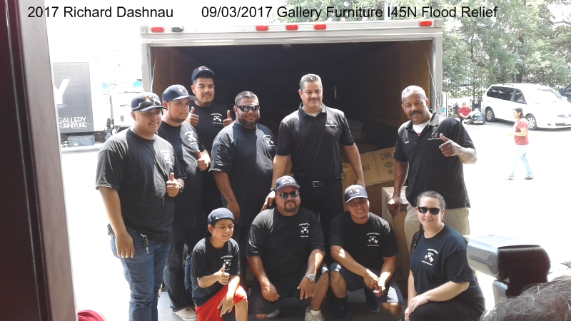
The two men
in the second row, right were employees of the furniture
store. But the rest of the group had arrived with 4 trucks
full of donated items.
And...they had driven in from Phoenix, Arizona. They had
"Hurricane Harvey Sustainable Landscape Services" on their
T-shirts, and they have two web pages:
https://www.facebook.com/sustainablels/ https://www.sustainablelandscapeservices.com/contact.html
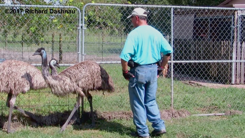
On the
following two weekends, I helped an old friend to remove parts
of her house to so flood-damaged walls could be repaired.m The
house is some distance from the center
of Houston, and there are a lot of animals there. But even
while dealing with this depressing situation, sometimes humor
can be found. I offered to clean-up a shelter that was
inside one of her fenced pens. I'd set up a camera to record
any interactions between me and the birds that lived in that
enclosure while I was cleaning up the shelter. The birds
didn't pay much attention to me, but there was some amusement
caught. The video clip is
here.
Brazos Bend State Park was closed a few days before Harvey
made landfall, and has been closed since. Due to flood damage,
it is tentatively scheduled to open sometime
in
November, 2017.
There is no way that anyone could plan to deal with the amount
of water that fell upon this part of Texas during those 4
days. Various areas got estimates between 24
and
50 inches of rain. To clarify
that is 2 to 4 FEET OF RAIN...IN FOUR DAYS! According to the
KTRK website, over 15,000 homes were destroyed, and over
200,000 homes were damaged in the city of Houston (in Harris
County)
and surrounding counties during Hurricane Harvey.
10/08/2017 I
visited my friend and helped out a little more. Besides
cleaning up some inside, I helped expand the Emu enclosure.
Before I left for the day, I spent a few minutes with the
emus, and shot
some short video clips. The two images below are frame grabs
from one edited video. The video can be seen at
this
link. While I was there, I shot some video
focusing on the stride of one of the emus.
I filmed at 120 frames per second, and that video is at
this link.

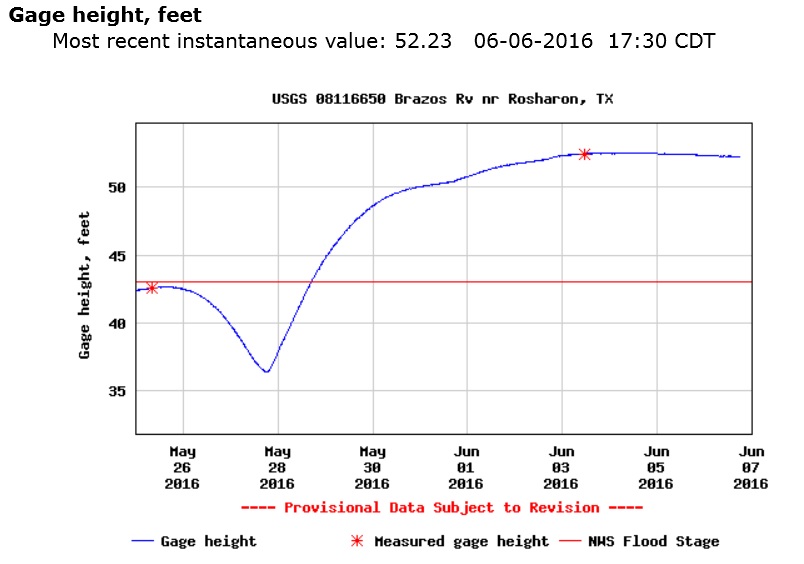
6/05/2016
Texas has been hit by rain and flooding
multiple times this Spring. The last batch of showers in North Texas put
a huge amount of water into various rivers--including the Brazos River.
This pile of water made its way South, and BBSP was closed 5/28/2016 in
preparation for the Brazos River to rise. And, the river did rise, as this
screengrab I got from the USGS site shows.
The river rose almost 10
feet above flood stage! This is a major disaster, and it
isn't over yet (as I write this 06/06/2016). It's sad that BBSP
was totally under water at this time LAST year.
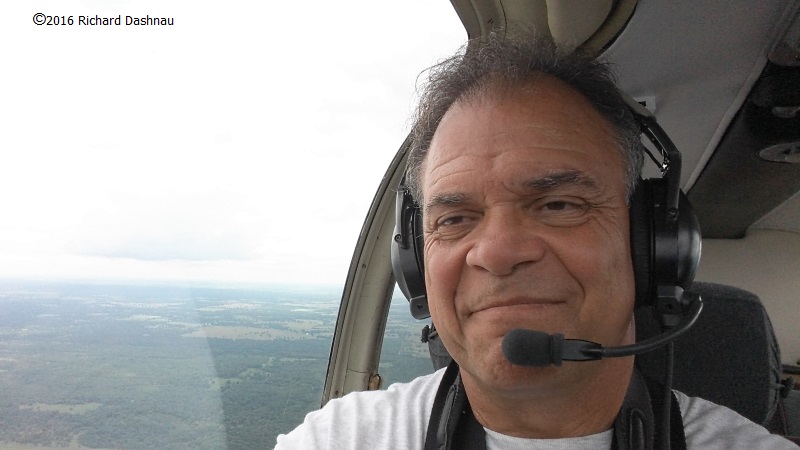
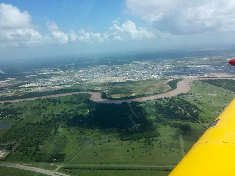
On Sunday, 06/05/2016 I was able to ride with a
friend in his plane over BBSP, and the surrounding area, for
about 45 minutes-until the rain started. I shot the images below
during the flight.
By using the zoom function, I could get past the wing-but
zooming too much caused too much camera shake. At the time I was
above the park taking these pictures (about 2:30 PM) the
flood gauge at 1462 showed 52.44 ft. The flood gauge is
located near the bridge at the top of the "1462" image.
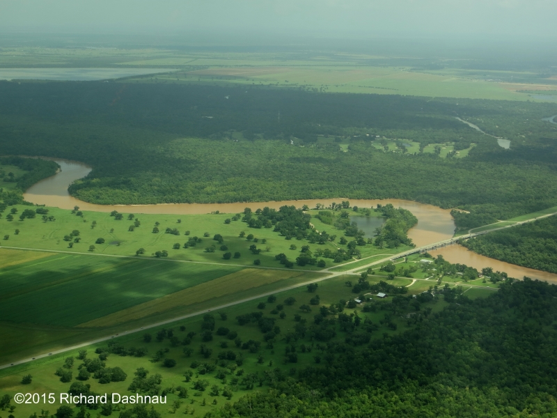
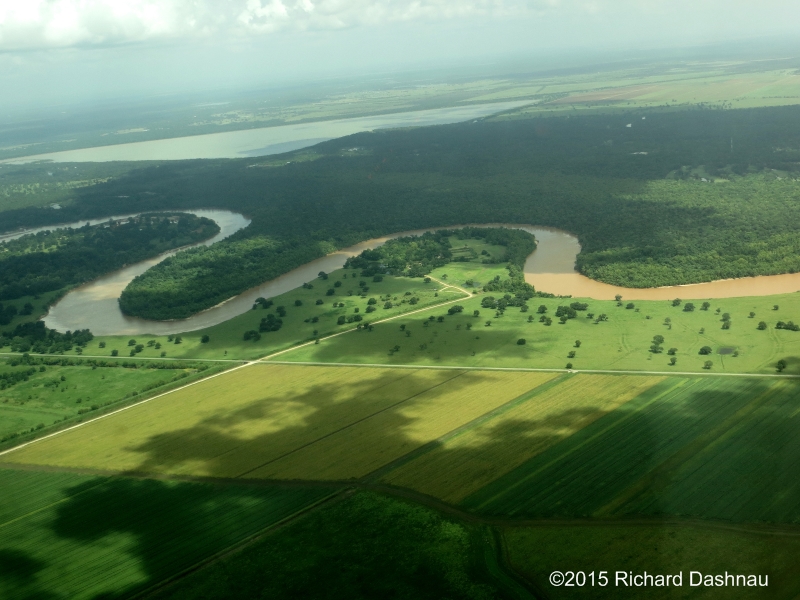
Pictures of Brazos Bend State Park ( it's possible to compare these to those I shot from the air last year). You can see the pictures from last year on my other page here.
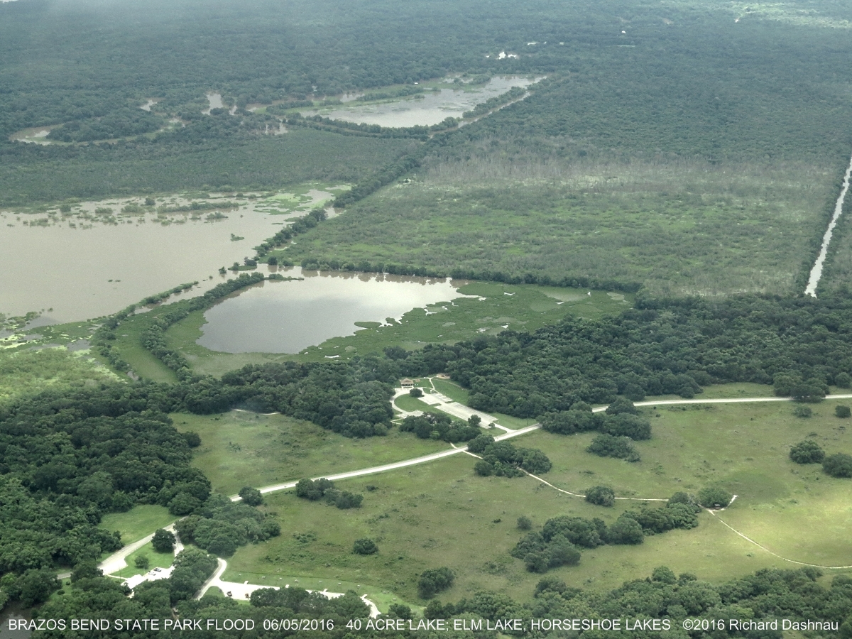
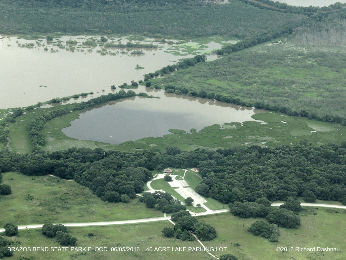
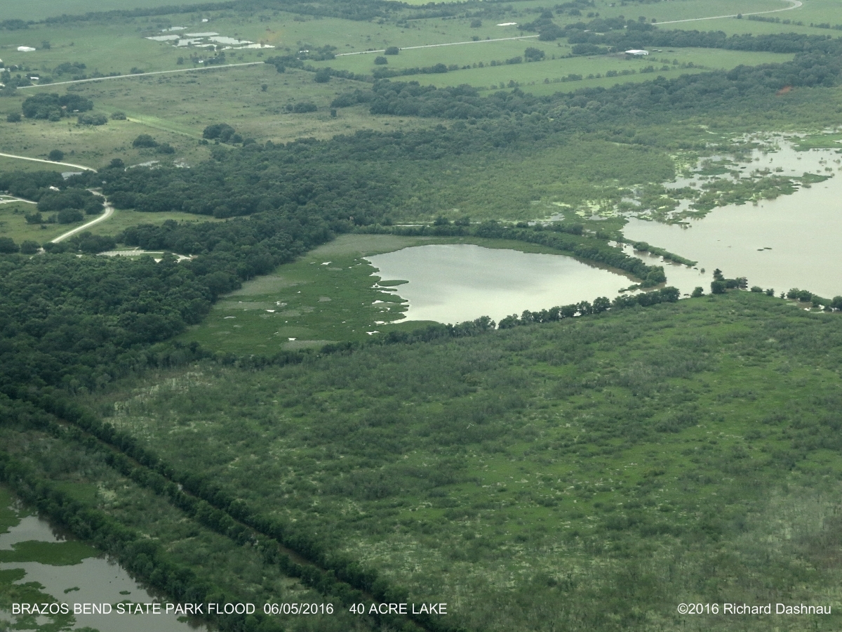
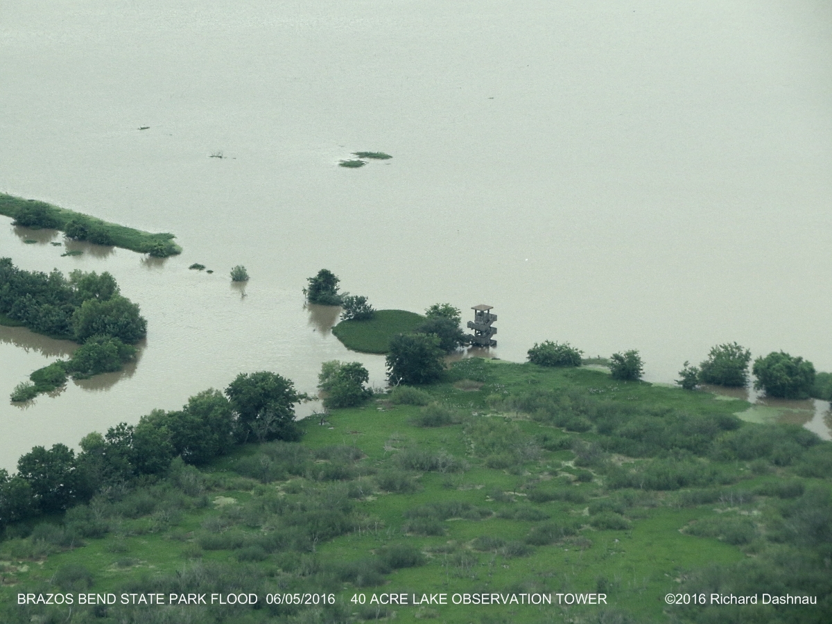
40 Acre Lake 40 Acre Lake 40 Acre Lake 40 Acre Lake
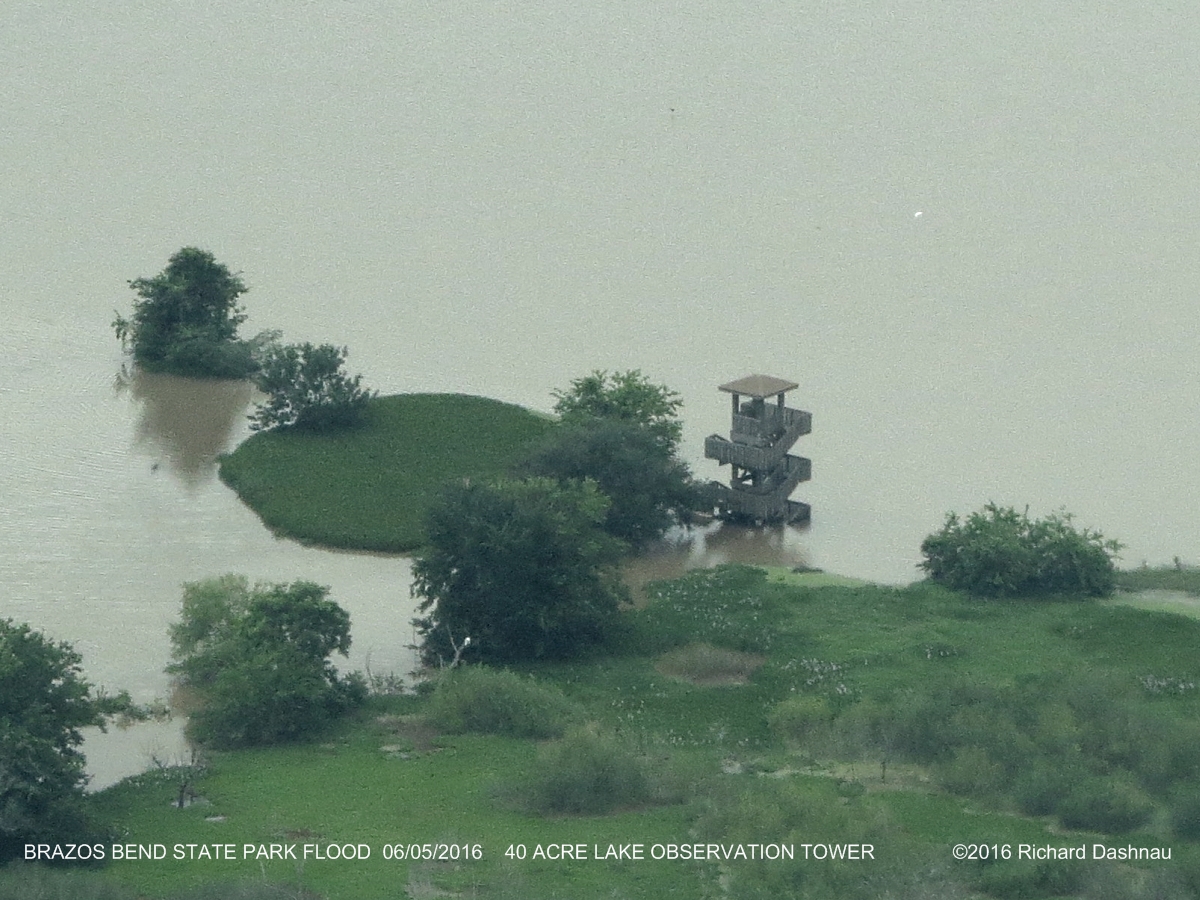

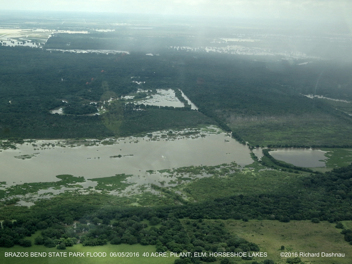
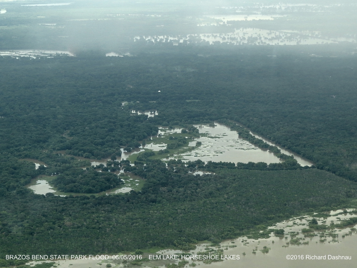
40 Acre Lake Observation Tower 40 Acre,Horseshoe,Elm Lakes 40 Acre,Pilant,Horseshoe,Elm Lakes Old & New Horseshoe & Elm Lakes

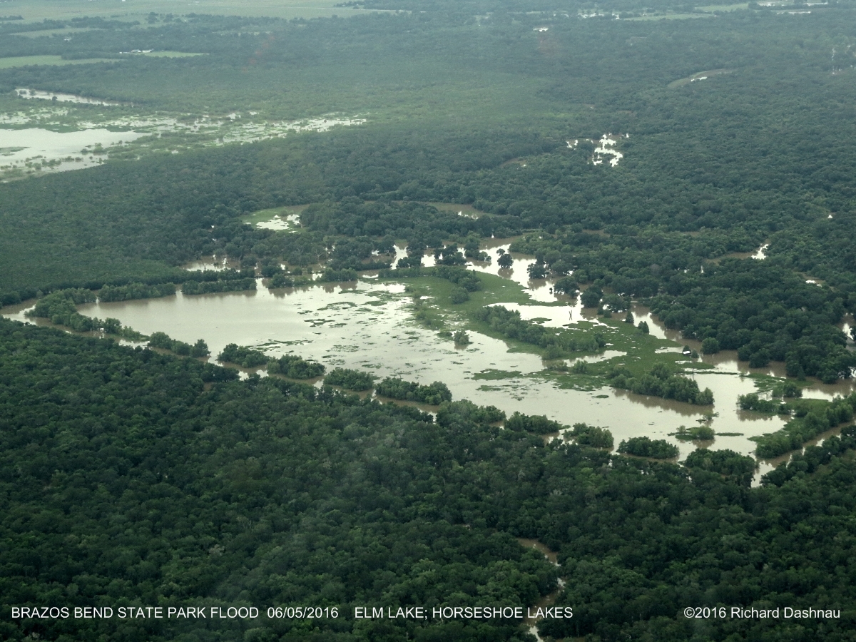

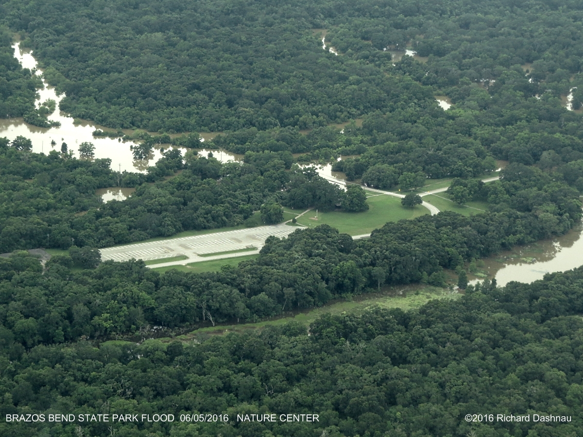
Old and New Horseshoe Lakes Elm Lake, Old and New Horseshoe Lakes Elm Lake and Old Horseshoe Lake Nature Center
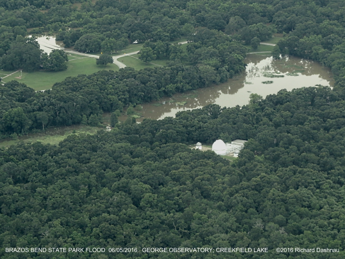
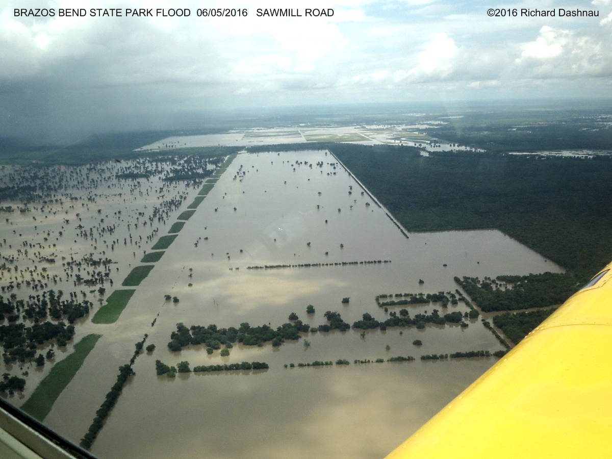
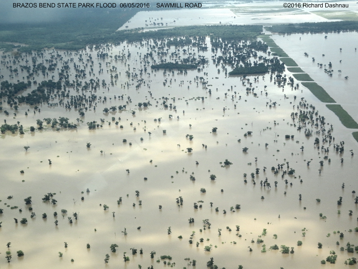
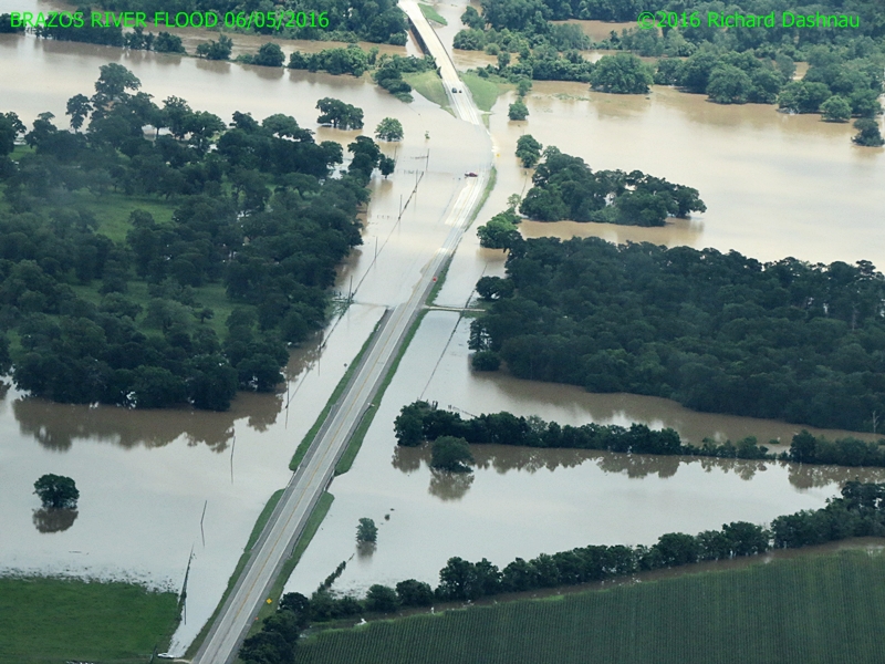
George Observatory & Creekfield Lake Sawmill Road Near Sawmill Road Hwy 1462 at the Brazos River
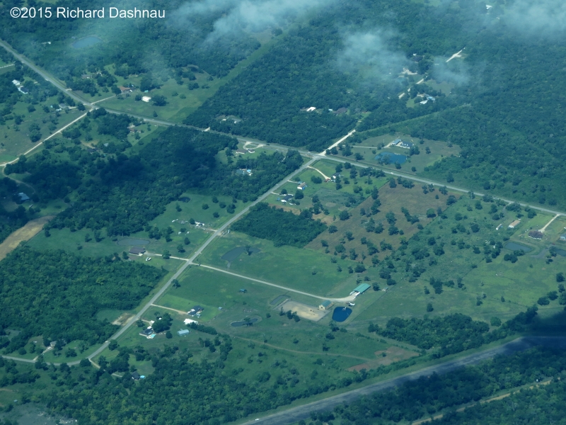
Pictures of areas around Brazos Bend State Park
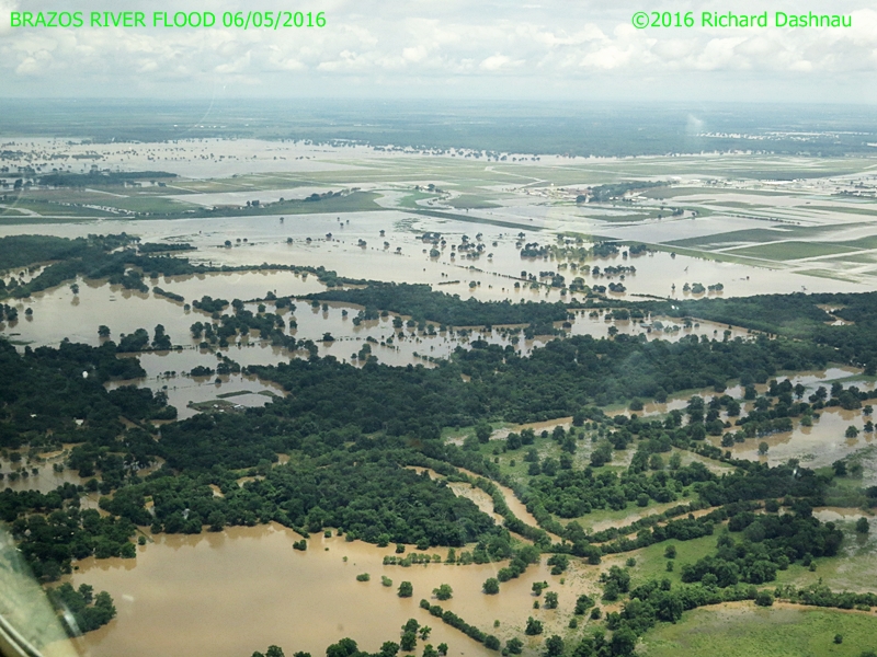

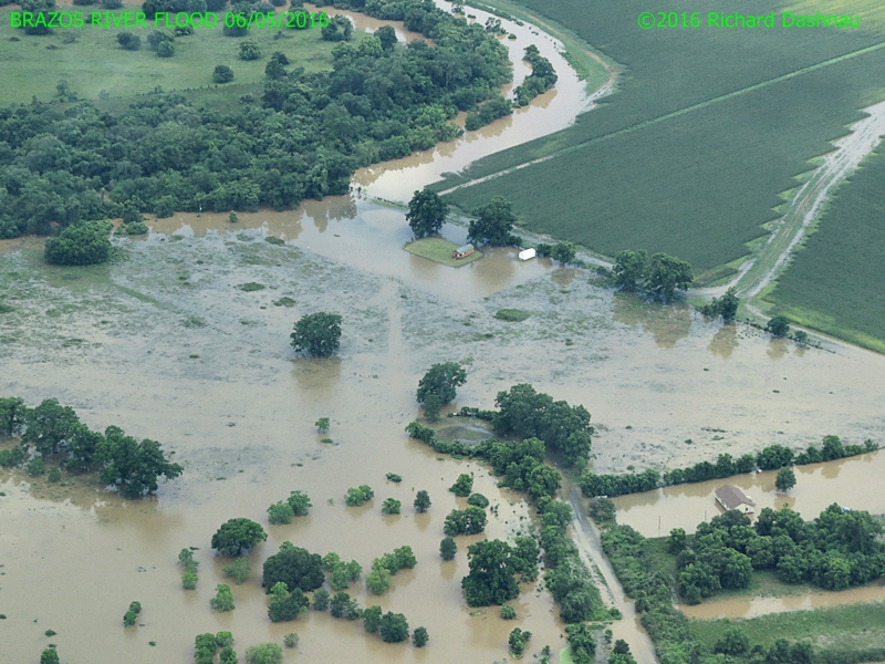
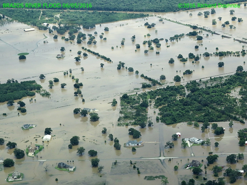
AREAS SOUTH OF 1462 AND EAST OF BBSP --------------------------------------------------------------------------------------------->
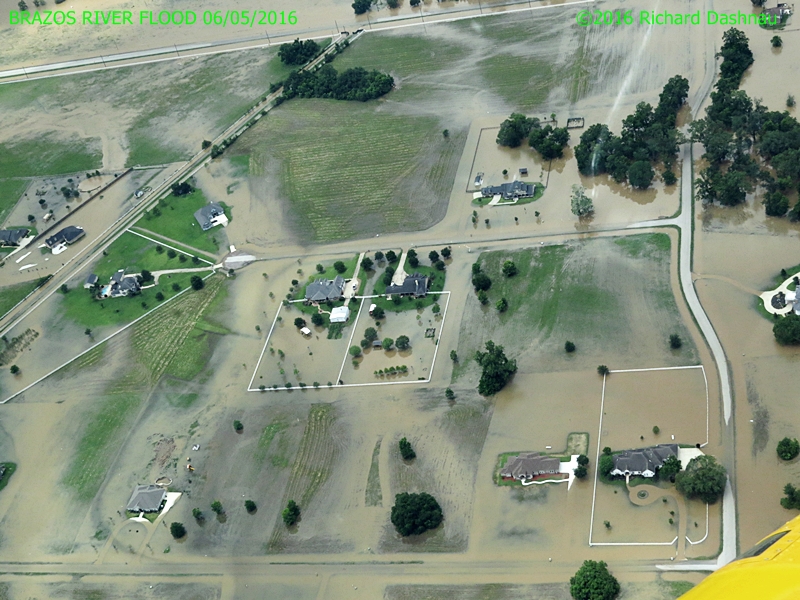
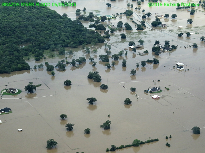
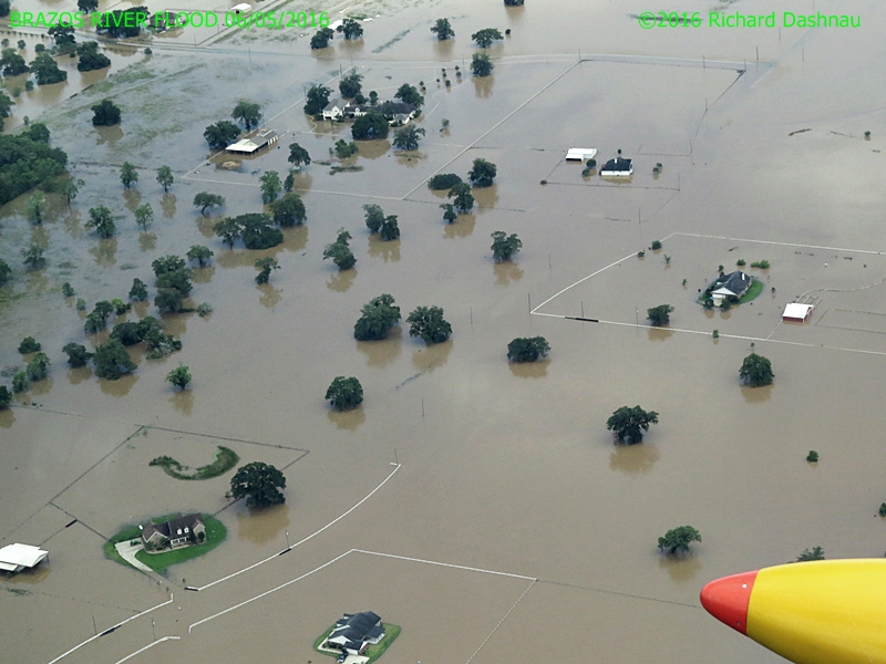
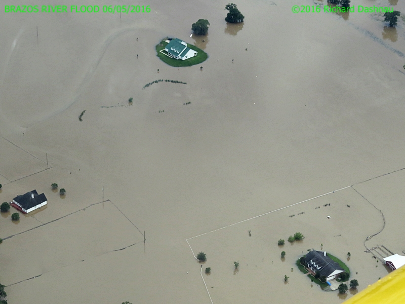
AREAS NORTH OF BBSP --------------------------------------------------------------------------------------------------------------->
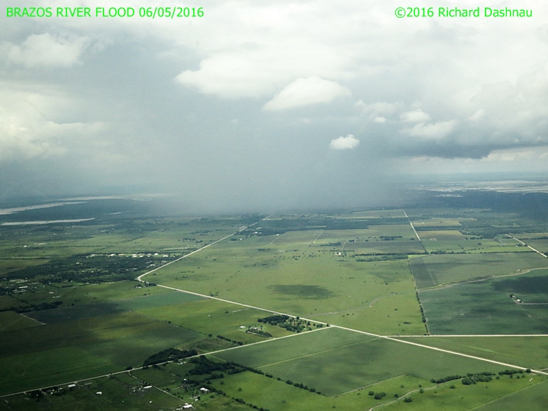

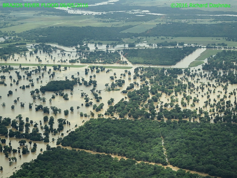
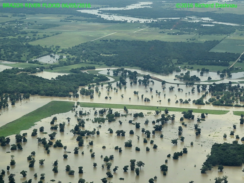
APPROACHING STORM SIENNA STABLES, ABOUT 8 MI. NORTH OF BBSP AREAS NORTH OF BBSP----------------------------------->
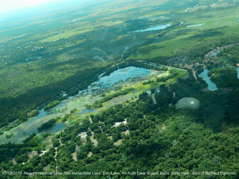
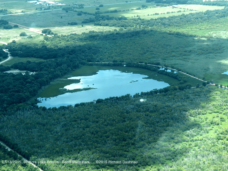
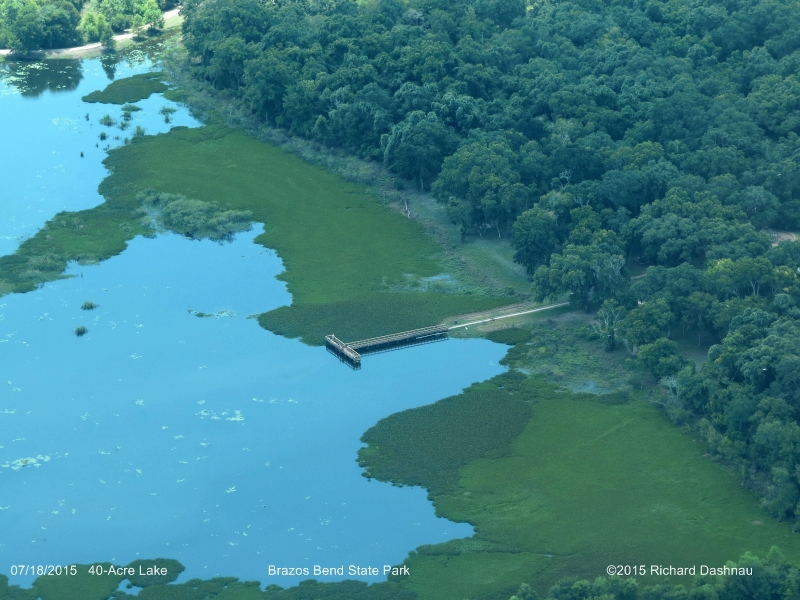
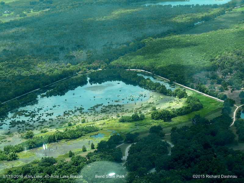
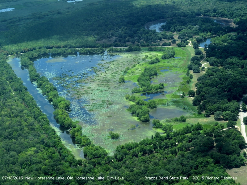
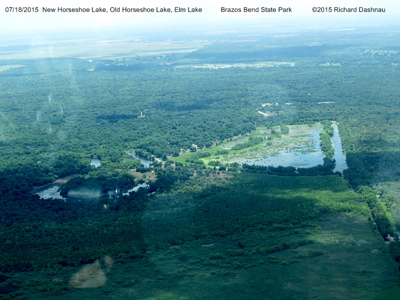
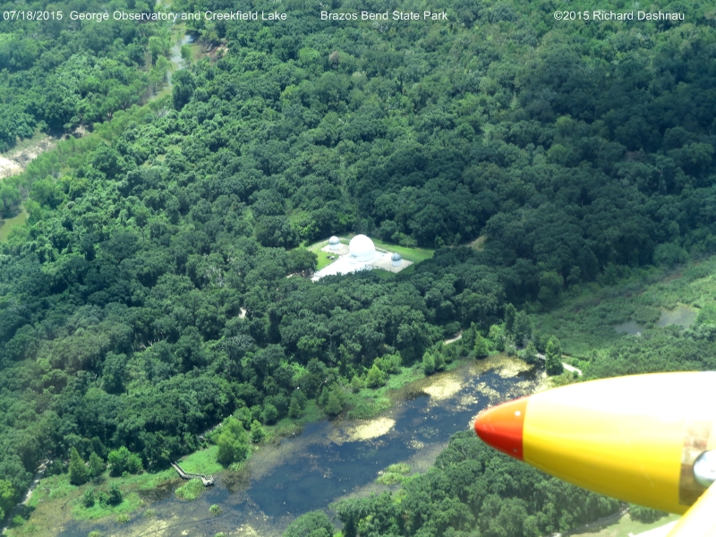
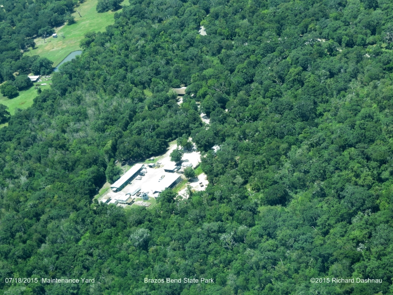
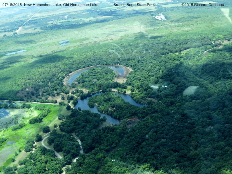
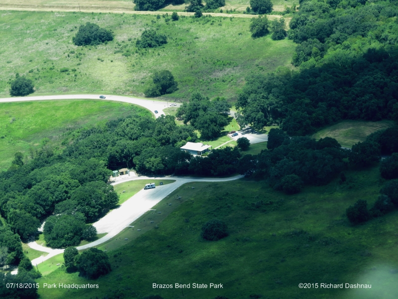
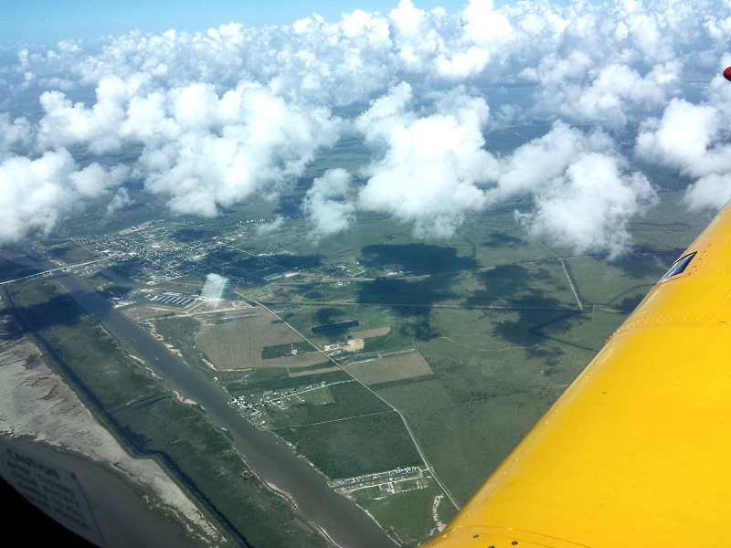
July
18, 2015 One
of
my co-workers has a small plane, and-since I'd expressed a
desire to get some pictures of Brazos Bend State Park-invited me
to fly over Texas
for a few hours. So, 3 of us went down to the coast, and
back, and we took a few turns over the park. I was able to get a
few pictures, and here they are. We were
flying at 1500 feet, and I used camera zoom when I could.
This is about a month after the flood pictures I took in
June (see below).
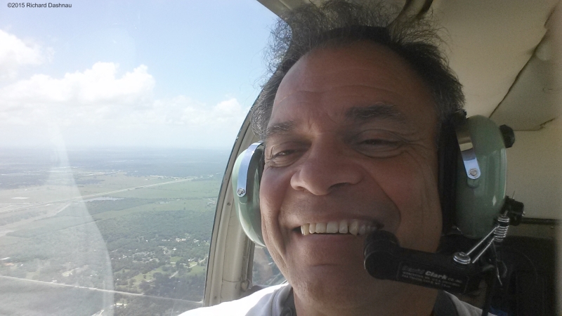
Me,
in the plane, above Texas
PICTURES OF BRAZOS BEND STATE PARK from above.
 --
-- -
- --
--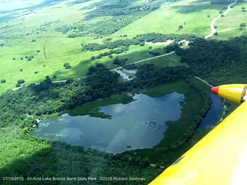
Elm, Old and New Horseshoe, 40 Acre Lakes
40 Acre
Lake
40 Acre Lake
40 Acre Lake
 --
-- -
- --
--
40 Acre Lake
Elm Lake and 40 Acre Lake
Elm, Old and New Horseshoe Lake
Old and New Horseshoe, Elm Lakes
 --
-- -
- --
--
George
Observatory
Maintenance Yard
Old and New Horseshoe
Lake
Park Headquarters
PICTURES OF OTHER SPOTS
 --
-- ---
---
Highway 809 @ 332 near Sweeny
Matagorda, Texas
Mine Lake and East Reservoir at the Gulf
Brazos River at Brazosport High School
 --
-- -
- --
--
Brazos River near Freeport
Brazos River at Highways 2004 and 400
Brazos River at Clemens Reservoir
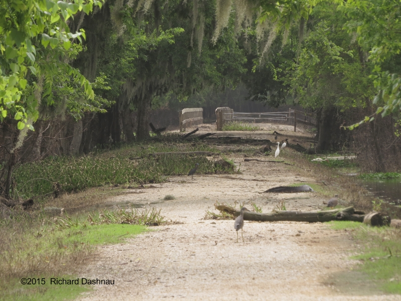
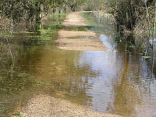
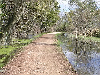
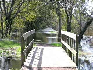
06/21/2015 Water has
receded more from Brazos Bend State Park, leaving the roads and
most of the trail clear. The river didn't rise as far and as
fast as had been
forecast. I was able to go out the the park for another guided
tour. I took a few pictures as I went on the tour around 2
lakes. 40 Acre Lake had a lot of debris. This
coming weekend will be the first in weeks that volunteers will
be allowed to work in the park--assisting various cleanup
duties. The park is still closed, and may be
for another few weeks. Check the state park page, the state
facebook page, and the volunteer website for more news.
 --
-- -
- --
--
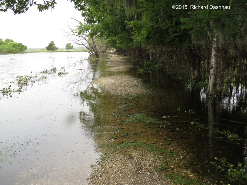
40 Acre lake looking East 6/21/15
40 Acre Lake near tower 06/21/2015
Spillway Trail looking at Bridge 6/21/15
Spillway Bridge
06/21/2015
Gator resting on the trail in front.
Water level can be seen on top
rails.
 --
-- -
- --
--
Spillway Trail just past bridge 6/21/15
Spillway Trail towards Elm Lake
06/21/2015 Pilant Slough Trail at Elm Lake 6/21/15
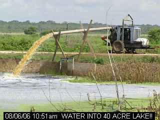
Water into 40Acre from Pilant Slough 06/21/2015
Dead area shows water level. Stick=6 feet
Water flowing into the lake as water rose again.
 --
--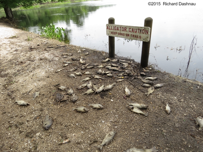
Birds Eating fish South 40Acre 6/21/15
Dead Fish South 40 Acre 06/21/2015
Dead fish probably killed by silt suspension in floodwaters. Many
bass, perch, crappie, bluegill.
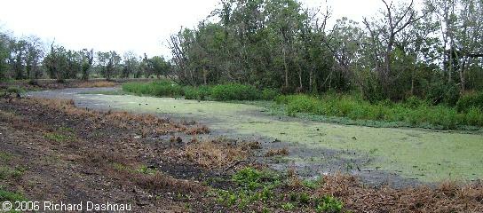
06/14/2015
Water has receded more
from Brazos Bend State Park, leaving the roads and some of the
trail clear--but many trails were still under water. I was able to
go
out the the park for another guided tour. I took a few
pictures. Some of them fit in with the large group of images
below. These few show where the water had been. In
the picture of Big Creek, the green ends where the water had been.
In the wood yard, the silt on the rope shows
how high the water had been.
Since the 14th, tropical
storm Bill dumped a lot of water throughout Texas. As I write this
(6/18/2015) they are forecasting that the Brazos River will rise
to about 50' at
the Rosharon gage sometime Saturday morning (6/20/2015). This will
probably cause the park to be flooded again. Tentative plans
were for the park to reopen 6/22/15
--but if the water rises as predicted, it probably won't reopen
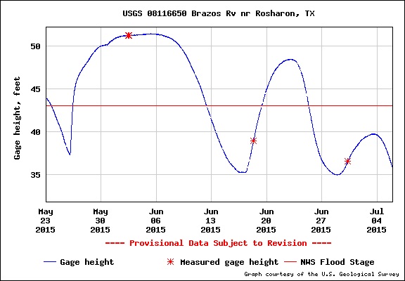
until sometime in July. The graph below shows how the Brazos River
height changed from May through July.
 -----
----- ---------
Big Creek between NC & Elm Lake 6/14/15
In the Wood Yard 06/14/2015
Brazos River levels at
Rosharon
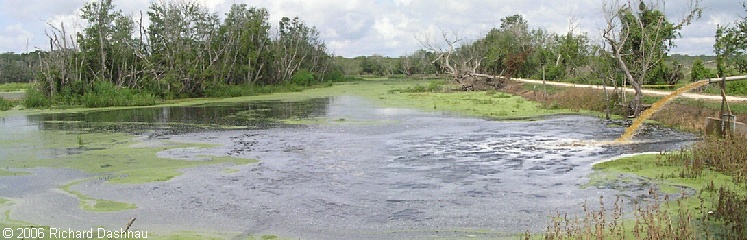
06/07/2015 Brazos Bend State
park was closed for business on 05/27/2015. Lots of rain
throughout Texas caused flash flooding in many areas, and
eventually raised
the water level in the Brazos River. The water level in the Brazos
River raised to 51.4
feet at Rosharon gage--about 2 river miles downstream from the mouth
of Big Creek.
The high water caused backflow into Big Creek, which winds
through the park. Big Creek overflowed, and pushed water into
Pilant Slough, which also overflowed and
filled the remainder of the park. Water levels in the park started
going down sometime on 6/6/2015. On 06/07/2015 park
management allowed for a "guided tour" of the
park for interested volunteers, so I was able to get pictures of
my own. Most of these are shown below. Note that these were
taken AFTER water had started to recede.
I went through my archive of older pictures, and tried to find
images of earlier times that corresponded to those I shot while
the park was under water. So the images are
in sets, with the older image first, followed by the recent
flooded image. Some of the older images are screen grabs
from "action camera" footage I filmed from my car.
Park is still closed today (6/11/2015)
 -
- -
- --
--
40-Acre lake pier 2013
40-Acre lake pier 2013
40-Acre lake pier
6/07/2015
 -
- -
- --
--
40-Acre lake pier 2013
40-Acre lake pier 6/07/2015
40-Acre Lake Pier 6/14/2015
 -
- -
-
40-Acre Observation Tower 2013
40-Acre
Observation Tower 6/07/2015
40-Acre Observation Tower 6/14/2015
 -
- -
- -
- -
-
Mile Stretch at curves sign 2014
Mile Stretch at curves
sign 2015
Mile Stretch at 2 signs 2014
Mile Stretch at 2 signs 2015
 -
- -
-
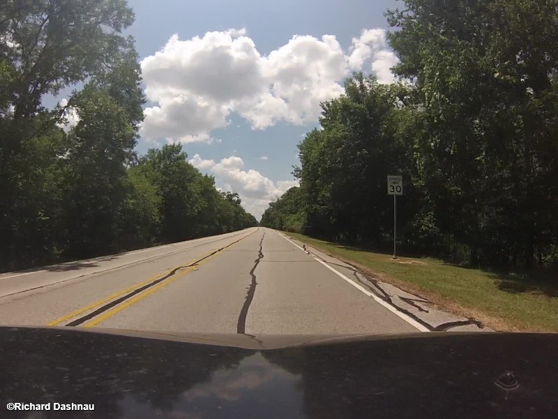
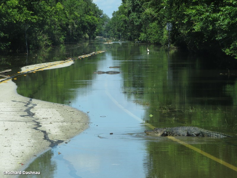
Mile Stretch at 30 mph sign 2014 Mile Stretch at 30 mph sign 2015
 -
- ------
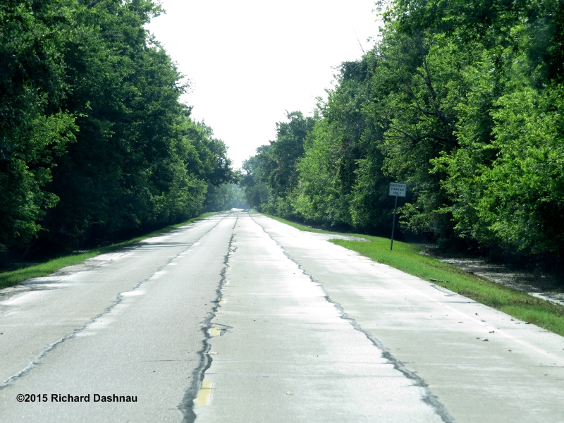
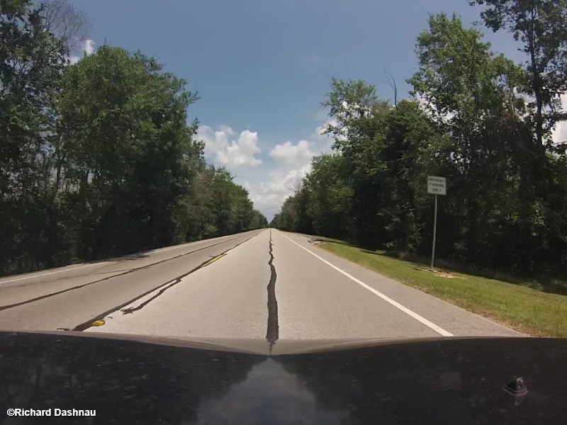
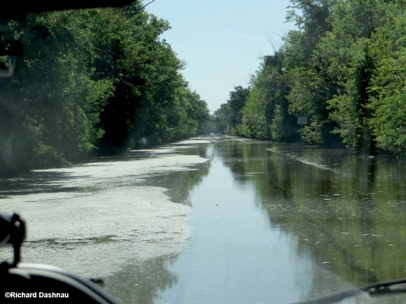
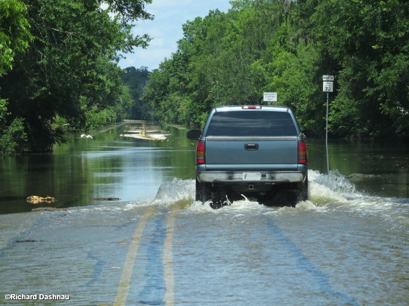
Mile Stretch; emergency parking sign 2014 Mile Stretch@Emergency pkg. sign 6/7/15 Mile Stretch@Emergency pkg. sign 6/14/15
 -
- -
- -
- -
-
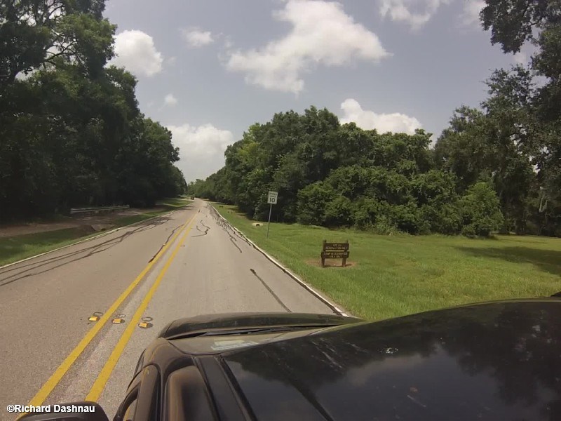
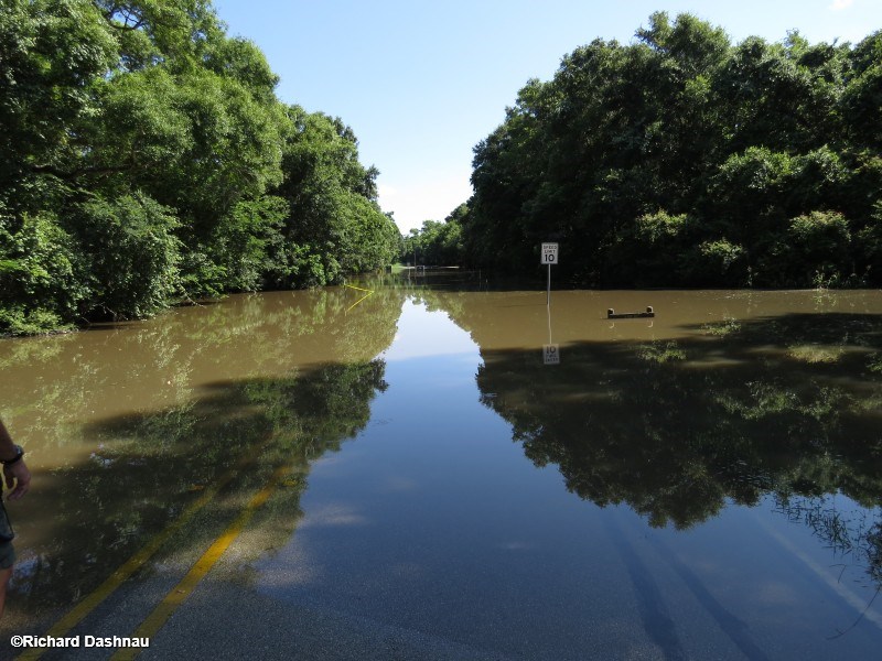
Mile Stretch at N72 sign 2014 Mile Stretch at N72 sign 2015 Park Road towards campgrounds 2014 Park Road towards campgrounds 6/7/2015
 -
- -
- -
- -
-
Park Road towards campgrounds 2014 Park Road towards campgrounds 6/7/2015 Park Road towards campgrounds 6/14/2015 Elm Lake Observation Platform 2011
 -
- -
- --
--
Elm Lake Observation Platform 2013 Elm Lake Observation Platform 2015 Leaving Elm Lake near 20mph sign 2014 Leaving Elm Lake near 20mph sign 2015
 ----
---- ----
---- --
--
Leaving Elm Lake 2014(Big Creek to left) Leaving Elm Lake 6/4/15(Big Creek to left) Leaving Elm Lake 6/14/15(Big Creek to left)
 -
- -
-
Leaving Elm Lake 2014(Big Creek to left) Leaving Elm Lake 2015(Big Creek to left)
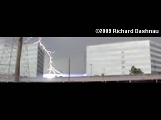
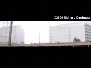
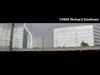
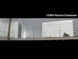
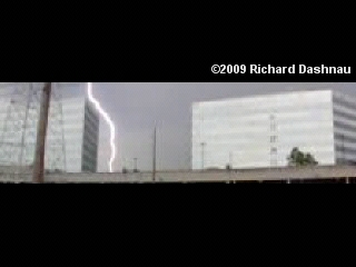
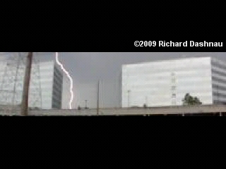
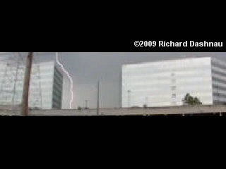
06/25/2009- Buddha (my dog) and I were at the Danny
Jackson Bark Park, when a storm appeared to the West, moving
towards me and the park (moving East). While I watched, I
could
see a lot of lightning. I had my pocket camera with me. This
is a Casio EX-FC100. It can shoot high-speed video. I thought I'd
try to catch some images of lightning with my camera. After a few
tries shooting bursts of photos (It's all luck. I had to point and
shoot and hope I caught something in the 30 images.) I decided
instead to try for video. The camera can shoot up to 1000 frames
per second (fps). It can't shoot at this rate for long for one
"burst". (More details on how this works are on my Slow
Motion
Video page.) Also, the frame size of the video is
short and long (and
rather small). Still, I decided to try. So, I just started
filming, and panned across the buildings at a steady rate. I did
this twice. I can't remember exactly how long I shot each time,
but the camera
won't allow more than about 30 seconds. I knew that I witnessed a
few flashes while shooting, but couldn't be sure the camera saw
them.
Although the camera shoots 1000 fps, captured frames
are placed in a video file formatted to play back at 30 fps--which
results in slow motion replay. One second shot at 1000fps
plays back
at 30 fps, or 33.3 times slower. Shooting 1 second at this
rate results in 33 seconds of viewing time, and this increases in
proportion. 10 seconds shot at 1000 fps will give 330 seconds
of
viewing time (or about 5 minutes)--and so on. That means that I
had a lot of "dead" video to look through. With the right
software, I can look at one frame at a time (which would take
forever,
ha ha) but each frame represents 1 thousandth of a second.
I reviewed the videos. I almost thought I
didn't get anything, but finally found a few flashes. Even at 1000
fps, the lightning was very
brief. By using a number of video editing programs
(Quicktime, Video Mach, Virtual Dub, Windows Movie Maker) I was
able to resize the frame, and to slow down the action even more.
After resizing and slowing down the video, I
captured frames from them. I did no other enhancements or
alterations to the images. Today's
RICKUBISCAM shows the view to the Southwest of my
position at the park. The storm is moving left to right in the
following frames, and the lightning strikes are South of me as I
pan across. Below are the frame captures. This stuff doesn't
feature
Buddha specifically, but she was there when it happened.
FIRST BOLT STREAMS
DOWN
BRIGHT
PULSE!
IONIZED AIR MAINTAINS GLOW
GLOW FADES
ESTABLISHING
SHOT BETWEEN
STREAMERS FROM
THE GROUND?
2ND BOLT, CONNECTION!
IONIZED PATH MAINTAINS
The weird artifact near the ground in the second image seems to be generated by the camera--perhaps because of the brightness of the image at that point.
GLOW
FADES
RETURN STREAMER STARTS FROM GROUND
2ND BOLT, SECOND
CONNECTION!
THIS MAINTAINS LONGER.
 -
- -
- -
-
3RDBOLT, PRIMARY
STREAMERS
3RD
BOLT, CONNECTION!
IONIZED PATH MAINTAINS
RETURN STREAMER STARTS FROM
GROUND.
The weird artifact near the ground in the first
image seems to be generated by the camera--perhaps because of the
brightness of the image at that point.
 -
- -
- -
-
3RD
BOLT, SECOND CONNECTION!
IONIZED PATH
MAINTAINS
GLOW FADES
-
Although these bolts are bright, they were quite far
away, judging by how long it took for the thunder to reach me. At
first glance, it's somewhat interesting that the primary and
return strokes have
exactly the same shape--but these all happened in fractions of a
second--long before air movement could change the shape of the
ionization path. Lightning occurs when a high charge
potential
builds between two points (ground and air, or air to air). The
current winds its way between these points until a primary
connection is made. Then the energy rushes to equalize, but
sometimes this
can flow one way, then the other until the charges dissipate. The
rushing energy ionizes (charges) the air, making it conductive and
causing it to glow. The surrounding air is rapidly heated
and
expands, causing thunder. I've
edited a video from these clips. It can be seen here: Lightning
at
Danny Jackson Bark Park 1000fps wmv 5.1mb
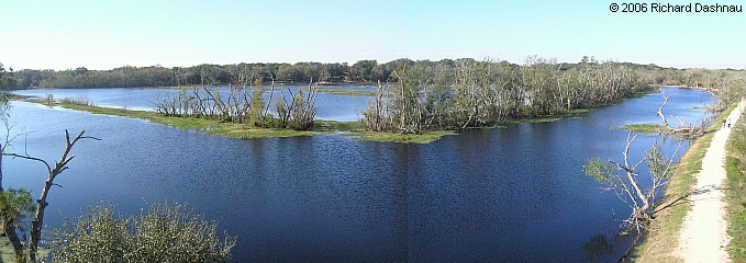
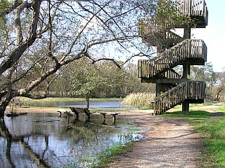
11/19/2006--Here is a picture I shot from the top of the Observation Tower at 40 Acre Lake. What an improvement from the summer! Click on the image for one that's a little bigger.
 -
- -
-
 -
- --
--
 -
-
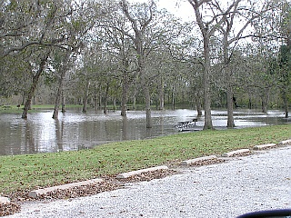
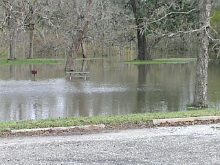
November 28, 2004Today was certainly a
NON-typical day at Brazos Bend State park. The Brazos River, and
Big Creek-which meet at the Southeast end of the park-were both
swollen with
rainwater, and were much higher than usual. The Brazos River had
breached its banks, and Big Creek was backflowing into the park
via Pilant Slough, although it had already breached its banks
in some areas. I was on the trails in the morning, and it was a
beautiful day.
---------------------------------------------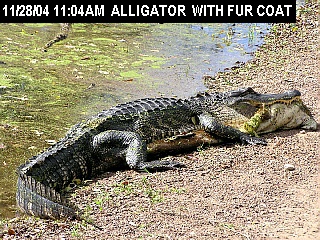
ALLIGATOR WITH SKIN
However, the water slowly crept
into the park. Here are some pictures I took as I walked the
park, and also did a short riding patrol with Chuck and Sharon.
I had scheduled two interpretive programs,
or else I would have stayed out on the trails longer. The
picture above shows an alligator that had come up onto the
40-Acre Lake trail (which hadn't flooded...yet) with a deerskin
in its jaws (I said the
alligator had a fur coat. I didn't say it was
wearing it.) The skin had
probably gotten washed into the water by the flooding, where the
alligator had found it. The alligator moved back into the water
and
slowly swam off when I got closer.
![]() -
- -
- -
- -
-
WITH
SKIN, CLOSER
WATER FLOW AT 40 ACRE
40 ACRE HIGH
WATER
40 ACRE/PILANT BRIDGE
 -
- -
- -
-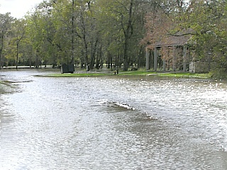
OBSERVATION TOWER
ELM LAKE PICNIC AREA
THAT'S BIG
CREEK!
HALE
LAKE PAVILION
 -
- -
- -
-
HALE
LAKE FISHING PIER
HALE LAKE PICNIC AREA
BLUESTEM TRAIL
ISLE OF BAD
INTENT
- -
- -
-
FLOATING
BADNESS
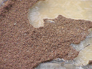
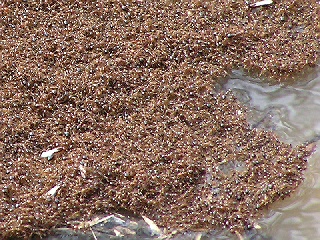
REALLY ANNOYED ANTS
FACING THE CAMPING LOOPS
As we went around Bluestem and Red Buckeyee trails, we encountered a number of floating ant mats. We stopped near one just long enough to get a few pictures (see ISLE OF BAD
 -
- -
-
- -
-
NO CAMPFIRES
TONIGHT
THAT'S BIG CREEK AGAIN
These pictures were all
taken before 12:00 PM Sunday. It was an odd feeling to ride
around in the partly sunny, calm weather and see all this water
slowly rising.
The water was still rising
Sunday evening. If anyone is interested in visiting the park
this coming week,it would be a good idea to call the park first
and check conditions there. The last news
I got (today, December 1) is that most of the park was under
water.
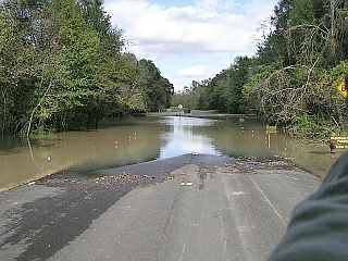
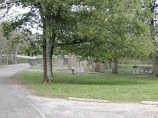
When Allison Hit Houston--Week of June 8, 2001
Through the week, various parts of Houston had been
hit by rain, and some areas to the south of town had already
received large amounts of rain. Then, on Friday evening, there
were warnings
of a probable visit by tropical storm Allison. I went to a movie
directly after work (I saw "Evolution"). This was at
multiplex cinema on the west side of town. To understand this
behavior, I suppose
you'd have to live here for some time. While rain is not a
threat every day, flash flood warnings are not uncommon whenever
rain is mentioned here.
After the movie, I drove to a restaurant not far from downtown
Houston. On the way, I hit fairly heavy rain. While I was in
the restaurant, I happened to look up at one of the television
sets that was
playing-sometime around 9:00 pm-and saw a Doppler radar image
very similar to what I show below (figure 1).
----------------------------------- 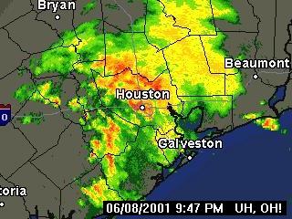
Figure 1.
I
finished my meal, and drove home. On the way, I noticed that some of
the streets started developing high water. I stayed on streets I was
familiar with, and those I knew were higher--that is, that
didn't dip under any overpasses, and so on. As I drove on, I notice
water starting to rise, and tried to take some pictures with the
digital camera I usually have with me. Since I was still
driving at
the time, and the torrents of water made it difficult to see
clearly, and the low light conditions; most of the pictures just
didn't come out well. I made a detour near my apartment to go to an
ATM. I
found myself on a side street with alarmingly high water. I then
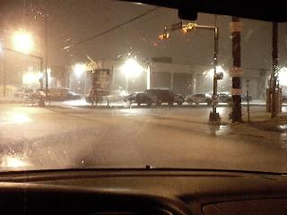
drove home, and encountered more high water. On one of the main
streets, the water was rising (figure 2). I got off these
streets
as soon as possible, and onto the lesser-traveled streets near my
house. But, these weren't much better. (figure 3.) Click on the
images to see them larger.
----------- ---------------------------------------------
Figure
2
figure 3
This
intersection is about a mile from my
house.
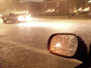
This
intersection is about one block from my house. This is the
high spot
It's
hard to tell, but that's water, not road
surface.
in
the road I'm on. That truck went in up over its headlights. So
did I.
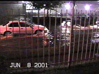
When I got home,I logged on,
and got the Doppler radar image shown in Figure 1. Not long
after that,I grabbed my video camera and took some movie footage
directly outside my apartment door.
Figure 4 (below)is an image from the video.Click here to see the video clip.(flv
video 2,519kb).
----- ---------------
figure
4.(click
image to
enlarge)
figure
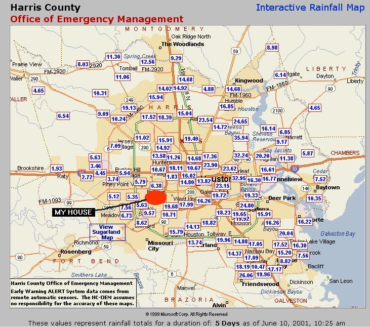
5.
I was very fortunate during this week. Take a look
at the rainfall map (click on figure
5). I've marked where I live. Note
that the heavy rainfall is not that far from where I am.
In some spots they recorded
over 30 inches of rain since tuesday (June 5). The heavy
rainfall hit close to downtown Houston, and on the other parts of
town, about 20-25 miles away from me. Some of this
occurred nearer the
Gulf of Mexico and the Ship Channel--effectively "downstream" from
where I am. Since they got so much water, though, the smaller
amount *I* received still caused flooding, since it had
nowhere to go.
I didn't know any of this Saturday morning. I went about my
business, and this was mostly on the west side of town. I didn't
see any current news media until I turned on the TV Saturday
evening. I *had*
heard that the heavy rain had disrupted newspaper deliveries, so I
hadn't seen a newspaper. Although I knew we'd had flooding (I'd
even seen some of it), I had just assumed that the water had
receded
much as it had done in my neighborhood. Then, I received a
huge shock when I turned on the TV. Every station was covering the
disastrous flooding. I don't know how much of this the rest
of y'all saw
on the news, but on the local stations it looked terrible.
The Houston Chronicle Online
has a lot of coverage showing what happened this city that I call
home. To those of you that have never been here, the pictures may
not say much. To me, they
are quite a shock. To see the full story, go to their page
covering the flood. Click on the link to get there: The
Great
Flood of 2001.
Go
back to my home page, Welcome to
rickubis.com
Go
back to the See
the World page.